
 Maureville
Samoëns
Gréning
Toulouse
Volx
Goudet
Méhoncourt
Saint-Hymer
Pontcarré
Maureville
Samoëns
Gréning
Toulouse
Volx
Goudet
Méhoncourt
Saint-Hymer
Pontcarré
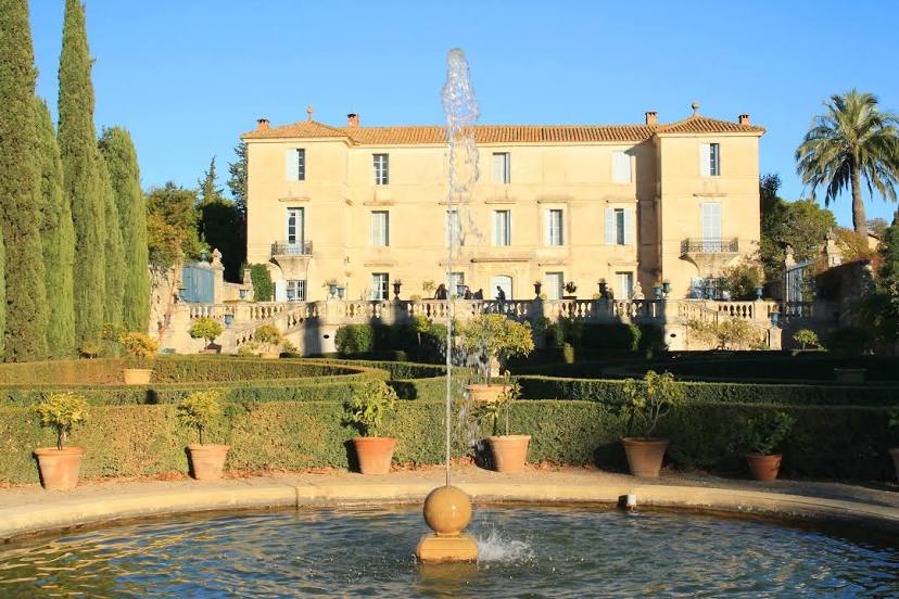
Parc et jardins du Château de Flaugergues on the map, Mauguio, France
Photo
Where is located Parc et jardins du Château de Flaugergues
Parc et jardins du Château de Flaugergues — local attraction, which is located at 1744 Av. Albert Einstein, 34000 Montpellier, France and belongs to the category — historical landmark. Average visitor rating for this place — 4.3 (according to 301 rating, information from open sources and relevant for 2022).
Exact location — Parc et jardins du Château de Flaugergues, marked on the map with a red marker.
You can get directions to Parc et jardins du Château de Flaugergues on the map from your location.
What else is interesting in Mauguio? You can see all the sights if you go to the city page.
Coordinates
Parc et jardins du Château de Flaugergues, France coordinates in decimal format: latitude — 43.61103903865847, longitude — 3.9181293978628746. When converted to degrees, minutes, seconds Parc et jardins du Château de Flaugergues has the following coordinates: 43°36′39.74 north latitude and 3°55′5.27 east longitude.
Nearby cities
The largest cities that are located nearby:
- Montpellier — 11 km
- Nimes — 37 km
- Marseille — 115 km
- Aix-en-Provence — 116 km
- Perpignan — 137 km
- Toulon — 164 km
- Saint-Étienne — 204 km
- Toulouse — 205 km
- Grenoble — 219 km
- Lyon — 246 km
- Villeurbanne — 248 km
- Clermont-Ferrand — 249 km
- Nice — 260 km
- Mataró
 (Spain) — 264 km
 - Sabadell (Spain) — 278 km
- Badalona (Spain) — 281 km
- Terrassa (Spain) — 281 km
- Santa Coloma de Gramenet (Spain) — 283 km
- L'Hospitalet de Llobregat (Spain) — 294 km
Distance to the capital
Distance to the capital (Paris) is about — 596 km.