
 Maureville
Samoëns
Gréning
Toulouse
Volx
Goudet
Méhoncourt
Saint-Hymer
Pontcarré
Maureville
Samoëns
Gréning
Toulouse
Volx
Goudet
Méhoncourt
Saint-Hymer
Pontcarré
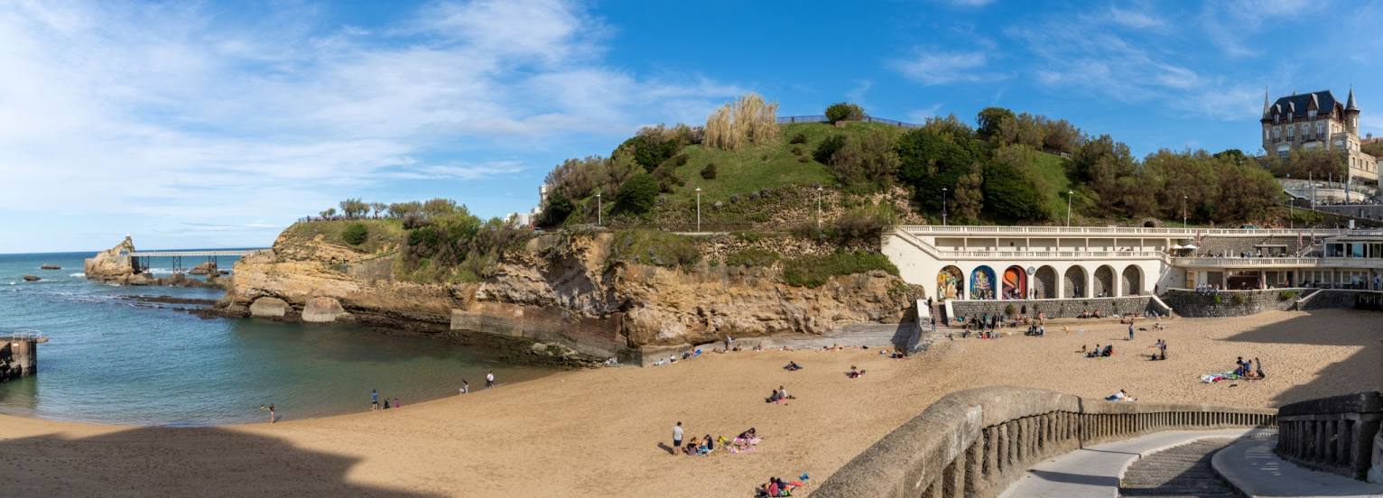
Plage du Port Vieux on the map, Biarritz, France
Photo
Where is located Plage du Port Vieux
Plage du Port Vieux — local attraction, which is located at no data and belongs to the category — -. Average visitor rating for this place — 4.6 (according to 79 ratings, information from open sources and relevant for 2022).
Exact location — Plage du Port Vieux, marked on the map with a red marker.
You can get directions to Plage du Port Vieux on the map from your location.
What else is interesting in Biarritz? You can see all the sights if you go to the city page.
Coordinates
Plage du Port Vieux, France coordinates in decimal format: latitude — 43.482525805767274, longitude — -1.5679475521412884. When converted to degrees, minutes, seconds Plage du Port Vieux has the following coordinates: 43°28′57.09 north latitude and -1°34′4.61 east longitude.
Nearby cities
The largest cities that are located nearby:
- San Sebastián
 (Spain) — 39 km
 - Pamplona (Spain) — 74 km
- Bilbao (Spain) — 113 km
- Vitoria-Gasteiz (Spain) — 114 km
- Logroño (Spain) — 134 km
- Bordeaux — 168 km
- Santander (Spain) — 181 km
- Zaragoza (Spain) — 210 km
- Burgos (Spain) — 215 km
- Toulouse — 241 km
- Lleida (Spain) — 274 km
- Gijón (Spain) — 329 km
- Valladolid (Spain) — 331 km
- Limoges — 339 km
- León (Spain) — 341 km
- Oviedo (Spain) — 345 km
- Tarragona (Spain) — 350 km
- Terrassa (Spain) — 364 km
- Alcala de Henares (Spain) — 365 km
Distance to the capital
Distance to the capital (Paris) is about — 669 km.