
 Maureville
Samoëns
Gréning
Toulouse
Volx
Goudet
Méhoncourt
Saint-Hymer
Pontcarré
Maureville
Samoëns
Gréning
Toulouse
Volx
Goudet
Méhoncourt
Saint-Hymer
Pontcarré
Pointe Saint-Martin on the map, Biarritz, France
Photo
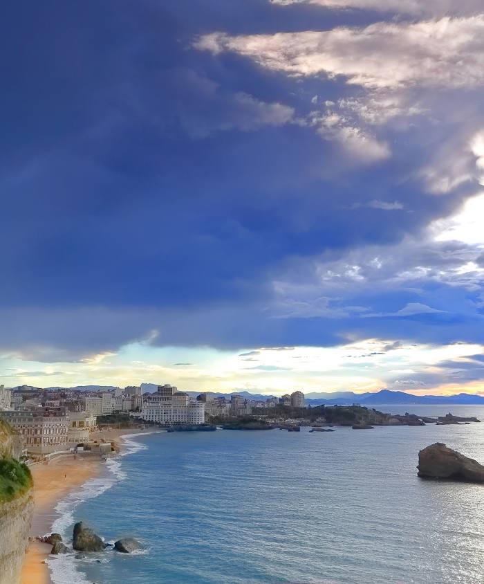
Where is located Pointe Saint-Martin
Pointe Saint-Martin — local attraction, which is located at no data and belongs to the category — -. Average visitor rating for this place — 4.3 (according to 6 ratings, information from open sources and relevant for 2022).
Exact location — Pointe Saint-Martin, marked on the map with a red marker.
You can get directions to Pointe Saint-Martin on the map from your location.
What else is interesting in Biarritz? You can see all the sights if you go to the city page.
Coordinates
Pointe Saint-Martin, France coordinates in decimal format: latitude — 43.493318783571794, longitude — -1.5540111262994374. When converted to degrees, minutes, seconds Pointe Saint-Martin has the following coordinates: 43°29′35.95 north latitude and -1°33′14.44 east longitude.
Nearby cities
The largest cities that are located nearby:
- San Sebastián
 (Spain) — 39 km
 - Pamplona (Spain) — 74 km
- Bilbao (Spain) — 113 km
- Vitoria-Gasteiz (Spain) — 114 km
- Logroño (Spain) — 134 km
- Bordeaux — 168 km
- Santander (Spain) — 181 km
- Zaragoza (Spain) — 210 km
- Burgos (Spain) — 215 km
- Toulouse — 241 km
- Lleida (Spain) — 274 km
- Gijón (Spain) — 329 km
- Valladolid (Spain) — 331 km
- Limoges — 339 km
- León (Spain) — 341 km
- Oviedo (Spain) — 345 km
- Tarragona (Spain) — 350 km
- Terrassa (Spain) — 364 km
- Alcala de Henares (Spain) — 365 km
Distance to the capital
Distance to the capital (Paris) is about — 668 km.