
 Maureville
Samoëns
Gréning
Toulouse
Volx
Goudet
Méhoncourt
Saint-Hymer
Pontcarré
Maureville
Samoëns
Gréning
Toulouse
Volx
Goudet
Méhoncourt
Saint-Hymer
Pontcarré
Centre d'art contemporain intercommunal - Istres on the map, Istres, France
Photo
Where is located Centre d'art contemporain intercommunal - Istres
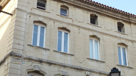
Centre d'art contemporain intercommunal - Istres — local attraction, which is located at 2 Rue Alphonse Daudet, 13800 Istres, France and belongs to the category — art museum. Average visitor rating for this place — 4.2 (according to 16 ratings, information from open sources and relevant for 2022).
Exact location — Centre d'art contemporain intercommunal - Istres, marked on the map with a red marker.
You can get directions to Centre d'art contemporain intercommunal - Istres on the map from your location.
What else is interesting in Istres? You can see all the sights if you go to the city page.
Coordinates
Centre d'art contemporain intercommunal - Istres, France coordinates in decimal format: latitude — 43.51277657526135, longitude — 4.987941997859704. When converted to degrees, minutes, seconds Centre d'art contemporain intercommunal - Istres has the following coordinates: 43°30′46 north latitude and 4°59′16.59 east longitude.
Nearby cities
The largest cities that are located nearby:
- Aix-en-Provence — 37 km
- Marseille — 39 km
- Nimes — 62 km
- Toulon — 87 km
- Montpellier — 90 km
- Nice — 183 km
- Perpignan — 193 km
- Grenoble — 194 km
- Saint-Étienne — 218 km
- Lyon — 249 km
- Villeurbanne — 250 km
- Turin
 (Italy) — 272 km
 - Toulouse — 284 km
- Clermont-Ferrand — 290 km
- Mataró
 (Spain) — 303 km
 - Geneva
 (Switzerland) — 310 km
 - Badalona (Spain) — 322 km
- Sabadell (Spain) — 323 km
- Santa Coloma de Gramenet (Spain) — 324 km
Distance to the capital
Distance to the capital (Paris) is about — 628 km.