 Liberal
Lake Elmo
Stephenson
Wildersville
Jellico
La Follette
Lenox
Elberton
Oliver Springs
Tazewell
Canaan
Tarboro
Kemah
National City
Clarksdale
Killingworth
Peterborough
Phippsburg
Atchison
Liberal
Lake Elmo
Stephenson
Wildersville
Jellico
La Follette
Lenox
Elberton
Oliver Springs
Tazewell
Canaan
Tarboro
Kemah
National City
Clarksdale
Killingworth
Peterborough
Phippsburg
Atchison
Tecate on the map, United States
Where is located Tecate
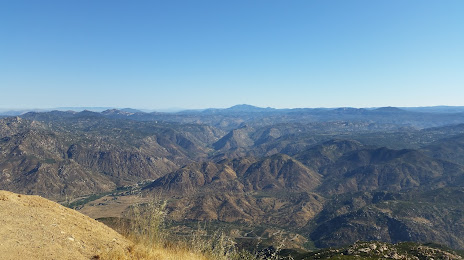
Exact location — Tecate, San Diego County, California, United States, marked on the map with a red marker.
Coordinates
Tecate, United States coordinates in decimal format: latitude — 32.5811734, longitude — -116.6209871. When converted to degrees, minutes, seconds Tecate has the following coordinates: 32°34′52.22 north latitude and -116°37′15.55 east longitude.
Population
Tecate, San Diego County, California, United States, according to our data the population is — 58,300 residents, which is about 0% of the total population of the country (United States).
Comparison of the population on the graph:
Exact time
Time zone for this location Tecate — UTC -7 America/Los_Angeles. Exact time — thursday, 4 april 2024 year, 21 h. 48 minutes.
Sunrise and sunset
Tecate, sunrise and sunset data for a date — thursday 25.04.2024.
| Sunrise | Sunset | Day (duration) |
|---|---|---|
| 06:07 -1 minute | 19:21 +1 minute | 13 h. 12 minutes. +2 minutes |
You can control the scale of the map using the auxiliary tools to find out exactly where it is located Tecate. When you change the scale of the map, the width of the ruler also changes (in kilometers and miles).
Nearby cities
The largest cities that are located nearby:
- Tijuana
 (Mexico) — 40 km
 - Chula Vista — 44 km
- San Diego — 52 km
- Escondido — 73 km
- Ensenada (Mexico) — 80 km
- Oceanside — 98 km
- Mexicali (Mexico) — 109 km
- Moreno Valley — 161 km
- Irvine — 163 km
- Costa Mesa — 167 km
- Corona — 167 km
- Riverside — 168 km
- Santa Ana — 172 km
- San Luis Río Colorado (Mexico) — 173 km
- Huntington Beach — 174 km
- Orange — 175 km
- Garden Grove — 179 km
- San Bernardino — 180 km
- Rialto — 182 km
Distance to neighboring capitals:
- Mexico City (Mexico) — 2273 km
- Belmopan
 (Belize) — 3270 km
 - Guatemala City
 (Guatemala) — 3309 km
 - Ottawa
 (Canada) — 3766 km
 - Nuuk
 (Greenland) — 5580 km
Attractions
Distance to the capital
Distance to the capital (Washington) is about — 3613 km.