
 Raidwangen
Sonneberg
Nortrup
Sankt Wolfgang
Mörsch
Roden
Gefell
Filsum
Aschau am Inn
Bredenbek
Pliening
Haltern
Schornsheim
Rowa
Oberpframmern
Empfingen
Marbach am Neckar
Starsiedel
Obertrubach
Raidwangen
Sonneberg
Nortrup
Sankt Wolfgang
Mörsch
Roden
Gefell
Filsum
Aschau am Inn
Bredenbek
Pliening
Haltern
Schornsheim
Rowa
Oberpframmern
Empfingen
Marbach am Neckar
Starsiedel
Obertrubach
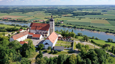
Bogen on the map, Germany
Where is located Bogen
Exact location — Bogen, Lower Bavaria, Bavaria, Germany, marked on the map with a red marker.
Coordinates
Bogen, Germany coordinates in decimal format: latitude — 48.9127889, longitude — 12.6927819. When converted to degrees, minutes, seconds Bogen has the following coordinates: 48°54′46.04 north latitude and 12°41′34.01 east longitude.
Population
Bogen, Lower Bavaria, Bavaria, Germany, according to our data the population is — 10,458 residents, which is about 0% of the total population of the country (Germany).
Comparison of the population on the graph:
Exact time
Time zone for this location Bogen — UTC +2 Europe/Berlin. Exact time — sunday, 5 may 2024 year, 12 h. 43 minutes.
Sunrise and sunset
Bogen, sunrise and sunset data for a date — sunday 12.05.2024.
| Sunrise | Sunset | Day (duration) |
|---|---|---|
| 05:34 -1 minute | 20:36 +1 minute | 15 h. 0 minutes. +2 minutes |
You can control the scale of the map using the auxiliary tools to find out exactly where it is located Bogen. When you change the scale of the map, the width of the ruler also changes (in kilometers and miles).
Nearby cities
The largest cities that are located nearby:
- Regensburg — 44 km
- Ingolstadt — 94 km
- Pilsen
 (Czech Republic) — 103 km
 - Munich — 119 km
- Salzburg
 (Austria) — 125 km
 - Nuremberg — 131 km
- Linz (Austria) — 135 km
- Fürth — 137 km
- Erlangen — 142 km
- Augsburg — 145 km
- Prague (Czech Republic) — 178 km
- Innsbruck (Austria) — 206 km
- Ulm — 206 km
- Chemnitz — 212 km
- Würzburg — 218 km
- Gera — 222 km
- Dresden — 247 km
- Heilbronn — 253 km
- Stuttgart — 256 km
Distance to neighboring capitals:
- Prague (Czech Republic) — 181 km
- Vienna (Austria) — 282 km
- Vaduz
 (Liechtenstein) — 307 km
 - Ljubljana
 (Slovenia) — 346 km
 - Bern
 (Switzerland) — 448 km
 - Brussels
 (Belgium) — 635 km
 - Amsterdam
 (Netherlands) — 671 km
 - Warsaw
 (Poland) — 693 km
 - Copenhagen
 (Denmark) — 752 km
 - Paris
 (France) — 756 km
 - Paris (France) — 756 km
- Rome
 (Italy) — 780 km
 - Minsk
 (Belarus) — 1168 km
 - Stockholm
 (Sweden) — 1205 km
 - Oslo
 (Norway) — 1230 km
 - Kyiv
 (Ukraine) — 1291 km
 - Helsinki
 (Finland) — 1476 km
Attractions


Distance to the capital
Distance to the capital (Berlin) is about — 404 km.