
 Golbey
Thiers
Chauray
Voiron
Bagnolet
Arras
Fournier
Ivry-sur-Seine
Argenteuil
Granville
Fouras
Ceyrat
Sèvres
Bruz
Bures-sur-Yvette
Éragny
Le Plessis-Robinson
Évreux
Lesquin
Golbey
Thiers
Chauray
Voiron
Bagnolet
Arras
Fournier
Ivry-sur-Seine
Argenteuil
Granville
Fouras
Ceyrat
Sèvres
Bruz
Bures-sur-Yvette
Éragny
Le Plessis-Robinson
Évreux
Lesquin
Taverny on the map, France
Where is located Taverny
Exact location — Taverny, Val-d'Oise, Île-de-France, France, marked on the map with a red marker.
Coordinates
Taverny, France coordinates in decimal format: latitude — 49.027441, longitude — 2.223507. When converted to degrees, minutes, seconds Taverny has the following coordinates: 49°1′38.79 north latitude and 2°13′24.63 east longitude.
Population
Taverny, Val-d'Oise, Île-de-France, France, according to our data the population is — 26,828 residents, which is about 0% of the total population of the country (France).
Comparison of the population on the graph:
Exact time
Time zone for this location Taverny — UTC +2 Europe/Paris. Exact time — thursday, 5 may 2024 year, 14 h. 55 minutes.
Sunrise and sunset
Taverny, sunrise and sunset data for a date — thursday 9.05.2024.
| Sunrise | Sunset | Day (duration) |
|---|---|---|
| 06:20 -1 minute | 21:14 +1 minute | 14 h. 54 minutes. +2 minutes |
You can control the scale of the map using the auxiliary tools to find out exactly where it is located Taverny. When you change the scale of the map, the width of the ruler also changes (in kilometers and miles).
Nearby cities
The largest cities that are located nearby:
- Boulogne-Billancourt — 21 km
- Rouen — 93 km
- Amiens — 96 km
- Orléans — 126 km
- Reims — 133 km
- Le Havre — 160 km
- Lille — 187 km
- Le Mans — 188 km
- Caen — 188 km
- Tours — 214 km
- Charleroi
 (Belgium) — 219 km
 - Eastbourne
 (United Kingdom) — 235 km
 - Namur (Belgium) — 245 km
- Brussels (Belgium) — 250 km
- Angers — 270 km
- Dijon — 283 km
- Crawley (United Kingdom) — 285 km
- Gillingham (United Kingdom) — 285 km
- Antwerp (Belgium) — 285 km
Distance to neighboring capitals:
- Brussels (Belgium) — 254 km
- London (United Kingdom) — 322 km
- Amsterdam
 (Netherlands) — 417 km
 - Bern
 (Switzerland) — 452 km
 - Vaduz
 (Liechtenstein) — 581 km
 - Andorra la Vella
 (Andorra) — 727 km
 - Berlin
 (Germany) — 876 km
 - Prague
 (Czech Republic) — 888 km
 - Copenhagen
 (Denmark) — 1018 km
 - Vienna
 (Austria) — 1043 km
 - Madrid
 (Spain) — 1065 km
 - Rome
 (Italy) — 1125 km
 - Warsaw
 (Poland) — 1368 km
 - Lisbon
 (Portugal) — 1461 km
 - Nicosia
 — 2966 km
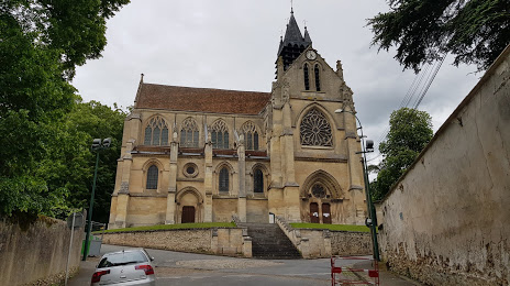
Attractions
Distance to the capital
Distance to the capital (Paris) is about — 21 km.