Tourville-la-Rivière — Cherbourg
Tourville-la-Rivière — Anet
Tourville-la-Rivière — Saint-Satur
Tourville-la-Rivière — Cessey-sur-Tille
Tourville-la-Rivière — Cardan
Tourville-la-Rivière — Limoges
Tourville-la-Rivière — Villefranche-sur-Saone
Tourville-la-Rivière — Montpon-Ménestérol
Tourville-la-Rivière — Avrillé
Tourville-la-Rivière — Les Forges
Tourville-la-Rivière — Ferran
Tourville-la-Rivière — Goustranville
Tourville-la-Rivière — La Fouillade
Tourville-la-Rivière — Les Allues
Tourville-la-Rivière — Montierchaume
Tourville-la-Rivière — Pérouges
Tourville-la-Rivière — Mévouillon
Tourville-la-Rivière — Oberschaeffolsheim
Tourville-la-Rivière — Étrez
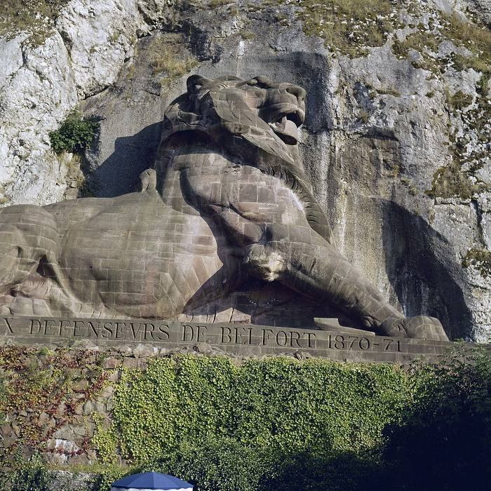
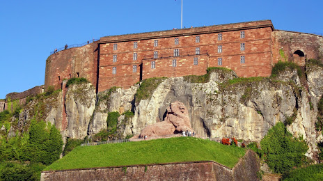
Tourville-la-Rivière — Belfort distance, route on the map
Distance by car
Distance between Tourville-la-Rivière, Upper Normandy, France and Belfort, Franche-Comté, France by car is — km, or miles. To travel this distance by car, you need minute, or h.
Route on the map, driving directions
Car route Tourville-la-Rivière — Belfort was created automatically. The road on the map is shown as a blue line. By moving the markers, you can create a new route through the points you need.
Distance by plane
If you decide to take a trip Tourville-la-Rivière Belfort by plane, then you have to fly the distance — 464 km or 288 miles. It is marked on the map with a gray line (between two points in a straight line).
Flight time
Estimated flight time Tourville-la-Rivière Belfort by plane at cruising speed 750 km / h will be — 37 min.
Direction of movement
France, Tourville-la-Rivière — right-hand traffic. France, Belfort — right-hand traffic.
Difference in time
Tourville-la-Rivière and Belfort are in the same time zone. Between them there is no time difference (UTC +2 Europe/Paris).
Interesting Facts
Information on alternative ways to get to your destination.
The length of this distance is about 1.2% of the total length of the equator.
The percentage of the population is clearly shown in the graph:
Tourville-la-Rivière — 2,336 (less by 48,473), Belfort — 50,809 residents.
The cost of travel
Calculate the cost of the trip yourself using the fuel consumption calculator, changing the data in the table.