RIOgaleão - Tom Jobim International Airport — Saint Andrew
RIOgaleão - Tom Jobim International Airport — Álvaro de Carvalho
RIOgaleão - Tom Jobim International Airport — Ubatuba
RIOgaleão - Tom Jobim International Airport — Santa Vitória
RIOgaleão - Tom Jobim International Airport — Feijó
RIOgaleão - Tom Jobim International Airport — Rodolfo Fernandes
RIOgaleão - Tom Jobim International Airport — Lagarto
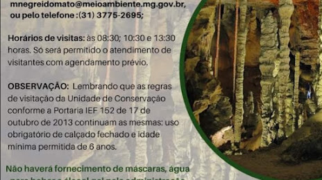
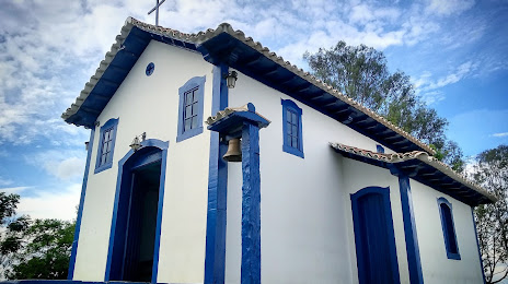
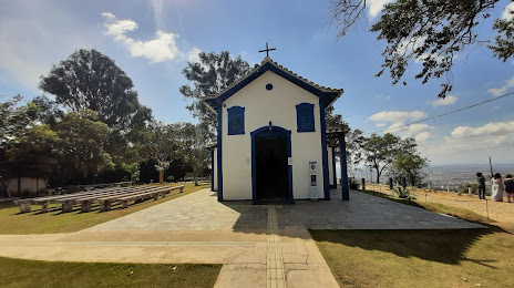
RIOgaleão - Tom Jobim International Airport — Catas Altas
RIOgaleão - Tom Jobim International Airport — Foz do Iguacu
RIOgaleão - Tom Jobim International Airport — Toledo
RIOgaleão - Tom Jobim International Airport — Itaperuçu
RIOgaleão - Tom Jobim International Airport — International Airport of Brasilia
RIOgaleão - Tom Jobim International Airport — Itaí
RIOgaleão - Tom Jobim International Airport — Bagé
RIOgaleão - Tom Jobim International Airport — Luiziânia
RIOgaleão - Tom Jobim International Airport — Populina
RIOgaleão - Tom Jobim International Airport — Patos de Minas
RIOgaleão - Tom Jobim International Airport — Papagaios
RIOgaleão - Tom Jobim International Airport — São Joaquim do Monte
Coriolano
Petrópolis
Petrópolis
Areal
Três Rios
Matias Barbosa
Aeroporto de Juiz de Fora
Santos Dumont
Galego
Barbacena
Cristiano Otoni
Congonhas
Barreiro
Calafate
Contagem
Ribeirão das Neves
Ribeirão das Neves
RIOgaleão - Tom Jobim International Airport — Saint Andrew
RIOgaleão - Tom Jobim International Airport — Álvaro de Carvalho
RIOgaleão - Tom Jobim International Airport — Ubatuba
RIOgaleão - Tom Jobim International Airport — Santa Vitória
RIOgaleão - Tom Jobim International Airport — Feijó
RIOgaleão - Tom Jobim International Airport — Rodolfo Fernandes
RIOgaleão - Tom Jobim International Airport — Lagarto
RIOgaleão - Tom Jobim International Airport — Catas Altas
RIOgaleão - Tom Jobim International Airport — Foz do Iguacu
RIOgaleão - Tom Jobim International Airport — Toledo
RIOgaleão - Tom Jobim International Airport — Itaperuçu
RIOgaleão - Tom Jobim International Airport — International Airport of Brasilia
RIOgaleão - Tom Jobim International Airport — Itaí
RIOgaleão - Tom Jobim International Airport — Bagé
RIOgaleão - Tom Jobim International Airport — Luiziânia
RIOgaleão - Tom Jobim International Airport — Populina
RIOgaleão - Tom Jobim International Airport — Patos de Minas
RIOgaleão - Tom Jobim International Airport — Papagaios
RIOgaleão - Tom Jobim International Airport — São Joaquim do Monte
Coriolano
Petrópolis
Petrópolis
Areal
Três Rios
Matias Barbosa
Aeroporto de Juiz de Fora
Santos Dumont
Galego
Barbacena
Cristiano Otoni
Congonhas
Barreiro
Calafate
Contagem
Ribeirão das Neves
Ribeirão das Neves
See how the reverse distance goes.
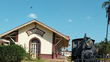
Sete Lagoas — RIOgaleão - Tom Jobim International AirportRIOgaleão - Tom Jobim International Airport — Sete Lagoas distance, route on the map
Distance by car
Distance between RIOgaleão - Tom Jobim International Airport, Rio de Janeiro, Brazil and Sete Lagoas, Minas Gerais, Brazil by car is — km, or miles. To travel this distance by car, you need minute, or h.
Route on the map, driving directions
Car route RIOgaleão - Tom Jobim International Airport — Sete Lagoas was created automatically. The road on the map is shown as a blue line. By moving the markers, you can create a new route through the points you need.
Passing cities through which the car route passes: Duque de Caxias, Coriolano, Petrópolis, Petrópolis, Areal, Três Rios, Matias Barbosa, Aeroporto de Juiz de Fora, Santos Dumont, Galego, Barbacena, Cristiano Otoni, Congonhas, Barreiro, Calafate, Contagem, Ribeirão das Neves, Ribeirão das Neves.
Distance by plane
If you decide to take a trip RIOgaleão - Tom Jobim International Airport Sete Lagoas by plane, then you have to fly the distance — 387 km or 240 miles. It is marked on the map with a gray line (between two points in a straight line).
Flight time
Estimated flight time RIOgaleão - Tom Jobim International Airport Sete Lagoas by plane at cruising speed 750 km / h will be — 30 min.
Direction of movement
Brazil, RIOgaleão - Tom Jobim International Airport — right-hand traffic. Brazil, Sete Lagoas — right-hand traffic.
Difference in time
RIOgaleão - Tom Jobim International Airport and Sete Lagoas are in the same time zone. Between them there is no time difference (UTC -3 America/Sao_Paulo).
Interesting Facts
Information on alternative ways to get to your destination.
The length of this distance is about 1.0% of the total length of the equator.
The cost of travel
Calculate the cost of the trip yourself using the fuel consumption calculator, changing the data in the table.