Campo Grande International Airport — Paulo Bento
Campo Grande International Airport — Paranaguá
Campo Grande International Airport — Viana
Campo Grande International Airport — Vale do Paraíso
Campo Grande International Airport — Cabeludo
Campo Grande International Airport — Itueta
Campo Grande International Airport — Quartel Geral
Campo Grande International Airport — Machadinho
Campo Grande International Airport — Pires Ferreira
Campo Grande International Airport — Ampére
Campo Grande International Airport — São João dos Patos
Campo Grande International Airport — Dores do Turvo
Campo Grande International Airport — Campinas
Campo Grande International Airport — Jericoacoara Beach
Campo Grande International Airport — Piracema
Campo Grande International Airport — Patos
Campo Grande International Airport — Chaves
Campo Grande International Airport — Altamira
Campo Grande International Airport — Querência
Três Lagoas
Castilho
Andradina
Mirandópolis
Valparaíso
Bento de Abreu
Guararapes
Araçatuba
Araçatuba
Birigui
Coroados
Penápolis
Promissão
Lins
Cafelândia
Borborema
Itápolis
Taquaritinga
Santo Antônio
Barrinha
Sertãozinho
Ribeirão Preto
Jardinópolis
Brodowski
Santo Antônio da Alegria
Passos
Capitolio
Formiga
Divinópolis
Nova Serrana
Igaratinga
Aeroporto De Para De Minas
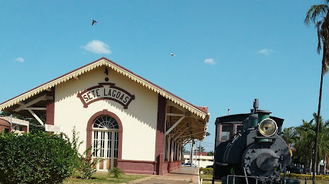
Campo Grande International Airport — Sete Lagoas distance, route on the map
Distance by car
Distance between Campo Grande International Airport, Mato Grosso do Sul, Brazil and Sete Lagoas, Minas Gerais, Brazil by car is — km, or miles. To travel this distance by car, you need minute, or h.
Route on the map, driving directions
Car route Campo Grande International Airport — Sete Lagoas was created automatically. The road on the map is shown as a blue line. By moving the markers, you can create a new route through the points you need.
Passing cities through which the car route passes: Campo Grande, Três Lagoas, Castilho, Andradina, Mirandópolis, Valparaíso, Bento de Abreu, Guararapes, Araçatuba, Araçatuba, Birigui, Coroados, Penápolis, Promissão, Lins, Cafelândia, Borborema, Itápolis, Taquaritinga, Santo Antônio, Barrinha, Sertãozinho, Ribeirão Preto, Jardinópolis, Brodowski, Santo Antônio da Alegria, Passos, Capitolio, Formiga, Divinópolis, Nova Serrana, Igaratinga, Aeroporto De Para De Minas.
Distance by plane
If you decide to take a trip Campo Grande International Airport Sete Lagoas by plane, then you have to fly the distance — 1096 km or 680 miles. It is marked on the map with a gray line (between two points in a straight line).
Flight time
Estimated flight time Campo Grande International Airport Sete Lagoas by plane at cruising speed 750 km / h will be — 1 h. and 27 min.
Direction of movement
Brazil, Campo Grande International Airport — right-hand traffic. Brazil, Sete Lagoas — right-hand traffic.
Difference in time
Campo Grande International Airport and Sete Lagoas are in different time zones. The time difference is 1 hour (UTC -4 America/Campo_Grande, UTC -3 America/Sao_Paulo).
Interesting Facts
Information on alternative ways to get to your destination.
The length of this distance is about 2.7% of the total length of the equator.
The cost of travel
Calculate the cost of the trip yourself using the fuel consumption calculator, changing the data in the table.