 Barraquito
Reform
Beautiful view
Monte Cristi
Santiago Rodriguez
Punta Cana
Bayahibe
Yamasá
San José de Ocoa
Ramon Santana
San Pedro de Macoris
Dominican Republic Air Force
Quisqueya
La Vega
Pimentel
San Carlos
Villa Tapia
Cristóbal
Villa Riva
Barraquito
Reform
Beautiful view
Monte Cristi
Santiago Rodriguez
Punta Cana
Bayahibe
Yamasá
San José de Ocoa
Ramon Santana
San Pedro de Macoris
Dominican Republic Air Force
Quisqueya
La Vega
Pimentel
San Carlos
Villa Tapia
Cristóbal
Villa Riva
Mao on the map, Dominican Republic
Where is located Mao
Exact location — Mao, Valverde, Dominican Republic, marked on the map with a red marker.
Coordinates
Mao, Dominican Republic coordinates in decimal format: latitude — 19.5511758, longitude — -71.0913748. When converted to degrees, minutes, seconds Mao has the following coordinates: 19°33′4.23 north latitude and -71°5′28.95 east longitude.
Population
Mao, Valverde, Dominican Republic, according to our data the population is — 48,297 residents, which is about 0.4% of the total population of the country (Dominican Republic).
Comparison of the population on the graph:
Exact time
Time zone for this location Mao — UTC -4 America/Santo_Domingo. Exact time — tuesday, 5 may 2024 year, 06 h. 58 minutes.
Sunrise and sunset
Mao, sunrise and sunset data for a date — tuesday 21.05.2024.
| Sunrise | Sunset | Day (duration) |
|---|---|---|
| 06:09 -0 minutes | 19:12 -0 minutes | 13 h. 6 minutes. -0 minutes |
You can control the scale of the map using the auxiliary tools to find out exactly where it is located Mao. When you change the scale of the map, the width of the ruler also changes (in kilometers and miles).
Nearby cities
The largest cities that are located nearby:
- Santiago De Los Caballeros — 42 km
- Puerto Plata — 49 km
- La Vega — 69 km
- San Francisco de Macoris — 92 km
- Cap-Haitien
 (Haiti) — 118 km
 - San Cristobal — 163 km
- Port-au-Prince (Haiti) — 172 km
- Carrefour (Haiti) — 178 km
- Léogâne (Haiti) — 197 km
- San Pedro de Macoris — 223 km
- La Romana — 255 km
- Punta Cana — 301 km
- Guantanamo
 (Cuba) — 433 km
 - Santiago de Cuba (Cuba) — 495 km
- Ponce
 (Puerto Rico) — 501 km
 - Palma Soriano (Cuba) — 513 km
- Bayamón
 (Puerto Rico) — 531 km
 - Saint John (Puerto Rico) — 536 km
- Holguin (Cuba) — 554 km
Distance to neighboring capitals:
- Port-au-Prince (Haiti) — 167 km
- Saint John (Puerto Rico) — 538 km
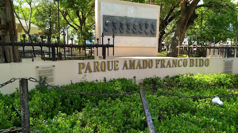
Attractions
Distance to the capital
Distance to the capital (Santo Domingo) is about — 170 km.