
 Miedzyrzec Podlaski
Pakość
Parczew
Grabów
Kaczory
Ujście
Margonin
Wisznice
Szczekociny
Konstantynów Łódzki
Wyszogród
Słupno
Twardogora
Krzepice
Mieszkowice
Czarna Białostocka
Choroszcz
Sidra
Zbąszyń
Miedzyrzec Podlaski
Pakość
Parczew
Grabów
Kaczory
Ujście
Margonin
Wisznice
Szczekociny
Konstantynów Łódzki
Wyszogród
Słupno
Twardogora
Krzepice
Mieszkowice
Czarna Białostocka
Choroszcz
Sidra
Zbąszyń
Świebodzice on the map, Poland
Where is located Świebodzice
Exact location — Świebodzice, Świdnica County, Lower Silesian Voivodeship, Poland, marked on the map with a red marker.
Coordinates
Świebodzice, Poland coordinates in decimal format: latitude — 50.8575475, longitude — 16.3213376. When converted to degrees, minutes, seconds Świebodzice has the following coordinates: 50°51′27.17 north latitude and 16°19′16.82 east longitude.
Population
Świebodzice, Świdnica County, Lower Silesian Voivodeship, Poland, according to our data the population is — 23,228 residents, which is about 0.1% of the total population of the country (Poland).
Comparison of the population on the graph:
Exact time
Time zone for this location Świebodzice — UTC +2 Europe/Warsaw. Exact time — thursday, 5 may 2024 year, 07 h. 41 minute.
Sunrise and sunset
Świebodzice, sunrise and sunset data for a date — thursday 9.05.2024.
| Sunrise | Sunset | Day (duration) |
|---|---|---|
| 05:17 -2 minutes | 20:24 +1 minute | 15 h. 6 minutes. +3 minutes |
You can control the scale of the map using the auxiliary tools to find out exactly where it is located Świebodzice. When you change the scale of the map, the width of the ruler also changes (in kilometers and miles).
Nearby cities
The largest cities that are located nearby:
- Walbrzych — 9 km
- Legnica — 40 km
- Wrocław — 57 km
- Opole — 114 km
- Zielona Gora — 132 km
- Olomouc
 (Czech Republic) — 155 km
 - Kalisz — 157 km
- Prague (Czech Republic) — 159 km
- Cottbus
 (Germany) — 169 km
 - Poznań — 176 km
- Gliwice — 177 km
- Rybnik — 179 km
- Ostrava (Czech Republic) — 180 km
- Dresden (Germany) — 181 km
- Zabrze — 184 km
- Brno (Czech Republic) — 185 km
- Ruda Slaska — 191 km
- Bytom — 192 km
- Częstochowa — 196 km
Distance to neighboring capitals:
- Prague (Czech Republic) — 159 km
- Berlin (Germany) — 273 km
- Vienna
 (Austria) — 295 km
 - Bratislava
 (Slovakia) — 307 km
 - Budapest
 (Hungary) — 423 km
 - Copenhagen
 (Denmark) — 591 km
 - Vilnius
 (Lithuania) — 737 km
 - Belgrade
 (Serbia) — 742 km
 - Bern
 (Switzerland) — 780 km
 - Amsterdam
 (Netherlands) — 806 km
 - Minsk
 (Belarus) — 834 km
 - Rīga
 (Latvia) — 847 km
 - Kyiv
 (Ukraine) — 1001 km
 - Bucharest
 (Romania) — 1023 km
 - Paris
 (France) — 1024 km
 - Helsinki
 (Finland) — 1168 km
 - Moscow
 (Russia) — 1509 km
 - Tbilisi
 (Georgia) — 2393 km
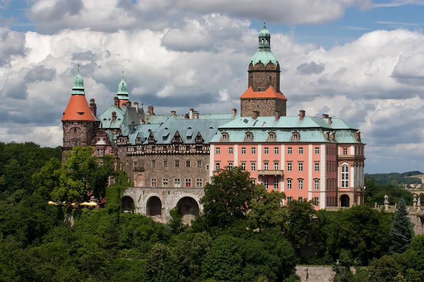
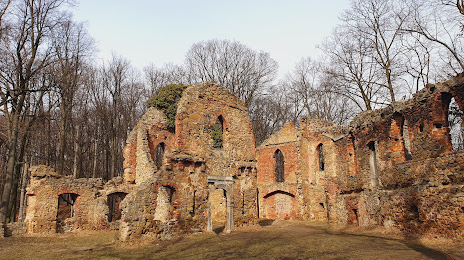
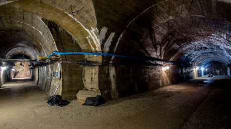
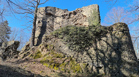
Attractions


Distance to the capital
Distance to the capital (Warsaw) is about — 358 km.