 San Martin of the Pyramids
Teotihuacan de Arista
Tezoyuca
Zinacantepec
Cologne Apatzingán
Maravatío
La Piedad de Cabadas
Xalisco
Banderas Bay
Bacalar
Sinaloa
Monterrey
Silao
Tonila
Villa Purification
Cuatro Caminos
Atenquique
Tuxpan
Zapotiltic
San Martin of the Pyramids
Teotihuacan de Arista
Tezoyuca
Zinacantepec
Cologne Apatzingán
Maravatío
La Piedad de Cabadas
Xalisco
Banderas Bay
Bacalar
Sinaloa
Monterrey
Silao
Tonila
Villa Purification
Cuatro Caminos
Atenquique
Tuxpan
Zapotiltic
Chiapa de Corzo on the map, Mexico
Where is located Chiapa de Corzo
Exact location — Chiapa de Corzo Chiapa de Corzo, Chiapas, Mexico, marked on the map with a red marker.
Coordinates
Chiapa de Corzo, Mexico coordinates in decimal format: latitude — 16.7021616, longitude — -93.0081378. When converted to degrees, minutes, seconds Chiapa de Corzo has the following coordinates: 16°42′7.78 north latitude and -93°0′29.3 east longitude.
Population
Chiapa de Corzo Chiapa de Corzo, Chiapas, Mexico, according to our data the population is — 32,182 residents, which is about 0% of the total population of the country (Mexico).
Comparison of the population on the graph:
Exact time
Time zone for this location Chiapa de Corzo — UTC -6 America/Mexico_City. Exact time — friday, 5 may 2024 year, 21 h. 02 minutes.
Sunrise and sunset
Chiapa de Corzo, sunrise and sunset data for a date — friday 10.05.2024.
| Sunrise | Sunset | Day (duration) |
|---|---|---|
| 05:45 -0 minutes | 18:31 -0 minutes | 12 h. 48 minutes. -0 minutes |
You can control the scale of the map using the auxiliary tools to find out exactly where it is located Chiapa de Corzo. When you change the scale of the map, the width of the ruler also changes (in kilometers and miles).
Nearby cities
The largest cities that are located nearby:
- Tuxtla Gutiérrez — 11 km
- San Cristóbal de las Casas — 39 km
- Villahermosa — 142 km
- Tapachula — 214 km
- Minatitlán — 215 km
- Coatzacoalcos — 220 km
- Ciudad del Carmen — 249 km
- Quetzaltenango
 (Guatemala) — 261 km
 - San Juan Sacatepéquez (Guatemala) — 335 km
- Guatemala City (Guatemala) — 351 km
- Villa Nueva (Guatemala) — 353 km
- Escuintla (Guatemala) — 356 km
- Villa Canales (Guatemala) — 363 km
- Oaxaca — 394 km
- Campeche — 431 km
- Córdoba — 475 km
- Santa Ana
 (El Salvador) — 477 km
 - Orizaba — 490 km
- Tehuacán — 500 km
Distance to neighboring capitals:
- Guatemala City (Guatemala) — 352 km
- Belmopan
 (Belize) — 455 km
 - Tegucigalpa
 (Honduras) — 686 km
 - Saint John
 (Puerto Rico) — 2857 km
 - Washington
 (United States) — 2917 km
 - Ottawa
 (Canada) — 3577 km
 - Belgrade
 (Serbia) — 10445 km
 - Podgorica
 (Montenegro) — 10482 km
 - Hagåtña
 (Guam) — 12843 km
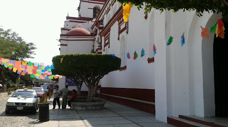
Attractions


Distance to the capital
Distance to the capital (Mexico City) is about — 715 km.