Calafate — Timóteo
Calafate — Centralina
Calafate — Praia Grande
Calafate — Posse
Calafate — Colinas do Tocantins
Calafate — Baependi
Calafate — Lins
Calafate — Juazeiro
Calafate — Bilac
Calafate — Ferreiros
Calafate — Planaltina
Calafate — Carapina
Calafate — Concórdia
Calafate — Balsa Nova
Calafate — Campina do Monte Alegre
Calafate — São Francisco de Itabapoana
Calafate — Morro Grande
Calafate — Bacurituba
Calafate — Wagner
Santarém
Uruará
Altamira
Km 100
Marabá
Araguaína
Nova Olinda
Colinas do Tocantins
Miranorte
Paraíso do Tocantins
Gurupi
Cariri do Tocantins
Porangatu
Uruaçu
Taguatinga
Luziânia
Cristalina
Paracatu
João Pinheiro
Três Marias
Paraopeba
Sete Lagoas
Ribeirão das Neves
Ribeirão das Neves
Contagem
Calafate
Barreiro
Congonhas
Viçosa
Coimbra
Muriaé
Raposo
Itaperuna
Bom Jesus do Norte
Bom Jesus do Itabapoana
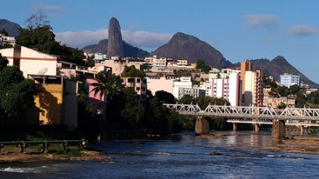
Calafate — Cachoeiro de Itapemirim distance, route on the map
Distance by car
Distance between Calafate, Amapá, Brazil and Cachoeiro de Itapemirim, Espírito Santo, Brazil by car is — km, or miles. To travel this distance by car, you need minute, or h.
Route on the map, driving directions
Car route Calafate — Cachoeiro de Itapemirim was created automatically. The road on the map is shown as a blue line. By moving the markers, you can create a new route through the points you need.
Passing cities through which the car route passes: Porto Grande, Santarém, Uruará, Altamira, Km 100, Marabá, Araguaína, Nova Olinda, Colinas do Tocantins, Miranorte, Paraíso do Tocantins, Gurupi, Cariri do Tocantins, Porangatu, Uruaçu, Taguatinga, Luziânia, Cristalina, Paracatu, João Pinheiro, Três Marias, Paraopeba, Sete Lagoas, Ribeirão das Neves, Ribeirão das Neves, Contagem, Calafate, Barreiro, Congonhas, Viçosa, Coimbra, Muriaé, Raposo, Itaperuna, Bom Jesus do Norte, Bom Jesus do Itabapoana.
Distance by plane
If you decide to take a trip Calafate Cachoeiro de Itapemirim by plane, then you have to fly the distance — 2773 km or 1719 miles. It is marked on the map with a gray line (between two points in a straight line).
Flight time
Estimated flight time Calafate Cachoeiro de Itapemirim by plane at cruising speed 750 km / h will be — 3 h. and 41 min.
Direction of movement
Brazil, Calafate — right-hand traffic. Brazil, Cachoeiro de Itapemirim — right-hand traffic.
Difference in time
Calafate and Cachoeiro de Itapemirim are in the same time zone. Between them there is no time difference (UTC -3 America/Fortaleza).
Interesting Facts
Information on alternative ways to get to your destination.
The length of this distance is about 6.9% of the total length of the equator.
The cost of travel
Calculate the cost of the trip yourself using the fuel consumption calculator, changing the data in the table.