
 Durango
Huerta
Sant Cugat del Vallès
Narón
Villarejo de Salvanés
Colmenar Viejo
Orga
Campofrío
Molíns
Fuente Álamo
Grandes
Used
San Miguel
Salcedo
Premià de Mar
Granja de Torrehermosa
Armenteros
Bañón
Bellver
Durango
Huerta
Sant Cugat del Vallès
Narón
Villarejo de Salvanés
Colmenar Viejo
Orga
Campofrío
Molíns
Fuente Álamo
Grandes
Used
San Miguel
Salcedo
Premià de Mar
Granja de Torrehermosa
Armenteros
Bañón
Bellver
Pasaia on the map, Spain
Where is located Pasaia
Exact location — Pasaia, Gipuzkoa, Euskadi, Spain, marked on the map with a red marker.
Coordinates
Pasaia, Spain coordinates in decimal format: latitude — 43.3254703, longitude — -1.9301396. When converted to degrees, minutes, seconds Pasaia has the following coordinates: 43°19′31.69 north latitude and -1°55′48.5 east longitude.
Population
Pasaia, Gipuzkoa, Euskadi, Spain, according to our data the population is — 15,990 residents, which is about 0% of the total population of the country (Spain).
Comparison of the population on the graph:
Exact time
Time zone for this location Pasaia — UTC +2 Europe/Madrid. Exact time — thursday, 5 may 2024 year, 05 h. 34 minutes.
Sunrise and sunset
Pasaia, sunrise and sunset data for a date — thursday 9.05.2024.
| Sunrise | Sunset | Day (duration) |
|---|---|---|
| 06:53 -1 minute | 21:15 +1 minute | 14 h. 24 minutes. +2 minutes |
You can control the scale of the map using the auxiliary tools to find out exactly where it is located Pasaia. When you change the scale of the map, the width of the ruler also changes (in kilometers and miles).
Nearby cities
The largest cities that are located nearby:
- San Sebastián — 4 km
- Pamplona — 61 km
- Vitoria-Gasteiz — 80 km
- Bilbao — 81 km
- Logroño — 104 km
- Santander — 152 km
- Burgos — 181 km
- Bordeaux
 (France) — 198 km
 - Zaragoza — 204 km
- Toulouse (France) — 272 km
- Lleida — 283 km
- Valladolid — 296 km
- Gijón — 300 km
- León — 307 km
- Oviedo — 315 km
- Alcala de Henares — 337 km
- Alcobendas — 340 km
- Torrejón de Ardoz — 343 km
- Tarragona — 360 km
Distance to neighboring capitals:
- Andorra la Vella
 (Andorra) — 296 km
 - Paris (France) — 698 km
- Paris (France) — 698 km
- Lisbon
 (Portugal) — 792 km
 - Rabat
 (Morocco) — 1124 km
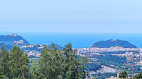
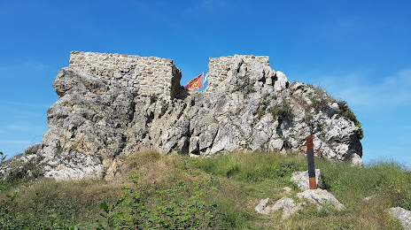
Attractions


Distance to the capital
Distance to the capital (Madrid) is about — 355 km.