
 Future
Carrasco
Amazon
Vereda La Palmilla
Narino
La Dolorosa
Florida
Risaralda
Hogar
MORELIA
Dapa
Rozo
Darien
El Pesaro
Villanueva
Stone bridge
Mosco
Saragossa
Mosquito
Future
Carrasco
Amazon
Vereda La Palmilla
Narino
La Dolorosa
Florida
Risaralda
Hogar
MORELIA
Dapa
Rozo
Darien
El Pesaro
Villanueva
Stone bridge
Mosco
Saragossa
Mosquito
Neira on the map, Colombia
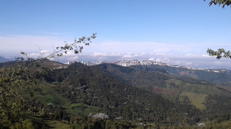
Where is located Neira
Exact location — Neira Neira, Caldas, Colombia, marked on the map with a red marker.
Coordinates
Neira, Colombia coordinates in decimal format: latitude — 5.166841, longitude — -75.520356. When converted to degrees, minutes, seconds Neira has the following coordinates: 5°10′0.63 north latitude and -75°31′13.28 east longitude.
Population
Neira Neira, Caldas, Colombia, according to our data the population is — 11,755 residents, which is about 0% of the total population of the country (Colombia).
Comparison of the population on the graph:
Exact time
Time zone for this location Neira — UTC -5 America/Bogota. Exact time — sunday, 4 april 2024 year, 15 h. 00 minutes.
Sunrise and sunset
Neira, sunrise and sunset data for a date — sunday 28.04.2024.
| Sunrise | Sunset | Day (duration) |
|---|---|---|
| 05:53 -0 minutes | 18:05 -0 minutes | 12 h. 12 minutes. -0 minutes |
You can control the scale of the map using the auxiliary tools to find out exactly where it is located Neira. When you change the scale of the map, the width of the ruler also changes (in kilometers and miles).
Nearby cities
The largest cities that are located nearby:
- Manizales — 11 km
- Dos Quebradas — 40 km
- Pereira — 43 km
- Cartago — 63 km
- Armenia — 72 km
- Ibagué — 87 km
- Itagüi — 111 km
- Envigado — 112 km
- Medellín — 122 km
- Girardot — 124 km
- Bello — 129 km
- Tuluá — 141 km
- Soacha — 157 km
- Buga — 164 km
- Palmira — 200 km
- Cali — 220 km
- Buenaventura — 222 km
- Villavicencio — 237 km
- Tunja — 243 km
Distance to neighboring capitals:
- Panama
 (Panama) — 612 km
 - Quito
 (Ecuador) — 679 km
 - San Jose
 (Costa Rica) — 1083 km
 - Caracas
 (Venezuela) — 1117 km
 - Georgetown
 (Guyana) — 1928 km
 - Nuestra Señora de La Paz
 (Bolivia) — 2543 km
 - Asuncion
 (Paraguay) — 3901 km
 - Santiago
 (Chile) — 4324 km
 - Buenos Aires
 (Argentina) — 4775 km
 - Montevideo
 (Uruguay) — 4896 km
Attractions
Distance to the capital
Distance to the capital (Bogota) is about — 172 km.