Chala
Magdalena
Scrapie
Pedro Ruiz
Oroya
Chongoyape
Cutervo
Bambamarca
Cascas
District of San Clemente
Province of Cotabambas
Tinco
The Tingo
Santa Cruz
Cayaltí
Reque
City Eten
Pimentel
Saint Rose
Chala
Magdalena
Scrapie
Pedro Ruiz
Oroya
Chongoyape
Cutervo
Bambamarca
Cascas
District of San Clemente
Province of Cotabambas
Tinco
The Tingo
Santa Cruz
Cayaltí
Reque
City Eten
Pimentel
Saint Rose
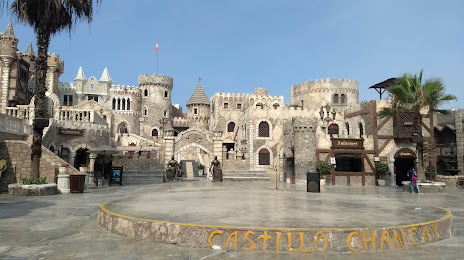
Chancay on the map, Peru
Where is located Chancay
Exact location — Chancay, Province of Huaral, Lima, Peru, marked on the map with a red marker.
Coordinates
Chancay, Peru coordinates in decimal format: latitude — -11.5741352, longitude — -77.2663771. When converted to degrees, minutes, seconds Chancay has the following coordinates: -11°34′26.89 north latitude and -77°15′58.96 east longitude.
Population
Chancay, Province of Huaral, Lima, Peru, according to our data the population is — 26,958 residents, which is about 0.1% of the total population of the country (Peru).
Comparison of the population on the graph:
Exact time
Time zone for this location Chancay — UTC -5 America/Lima. Exact time — wednesday, 6 june 2024 year, 10 h. 00 minutes.
Sunrise and sunset
Chancay, sunrise and sunset data for a date — wednesday 12.06.2024.
| Sunrise | Sunset | Day (duration) |
|---|---|---|
| 06:28 +1 minute | 17:50 +1 minute | 11 h. 24 minutes. -0 minutes |
You can control the scale of the map using the auxiliary tools to find out exactly where it is located Chancay. When you change the scale of the map, the width of the ruler also changes (in kilometers and miles).
Nearby cities
The largest cities that are located nearby:
- Callao — 55 km
- Lima — 58 km
- Huanuco — 213 km
- Huancayo — 229 km
- Chincha Alta — 238 km
- Chimbote — 313 km
- Ica — 322 km
- Ayacucho — 372 km
- Trujillo — 429 km
- Pucallpa — 458 km
- Cajamarca — 507 km
- Chiclayo — 601 km
- Cusco — 609 km
- Piura — 796 km
- Arequipa — 809 km
- Sullana — 828 km
- Loja
 (Ecuador) — 866 km
 - Juliaca — 875 km
- Santiago (Ecuador) — 889 km
Distance to neighboring capitals:
- Nuestra Señora de La Paz
 (Bolivia) — 1126 km
 - Quito (Ecuador) — 1274 km
- Bogota
 (Colombia) — 1833 km
 - Santiago
 (Chile) — 2523 km
 - Asuncion
 (Paraguay) — 2570 km
 - Caracas
 (Venezuela) — 2709 km
 - Buenos Aires
 (Argentina) — 3195 km
 - Montevideo
 (Uruguay) — 3358 km