Monjolo
Flour
Day
Porto Alegre
Goias
Queluz
Amapá
State of Amazonas
Department
Vitoria
Ferrugem
Piracicaba
Santa Cruz Cabrália
Mendes
St. Catarina
Sousas
Santa Cruz do Sul
Jerônimo
North English
Monjolo
Flour
Day
Porto Alegre
Goias
Queluz
Amapá
State of Amazonas
Department
Vitoria
Ferrugem
Piracicaba
Santa Cruz Cabrália
Mendes
St. Catarina
Sousas
Santa Cruz do Sul
Jerônimo
North English
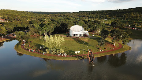
Jataí on the map, Brazil
Where is located Jataí
Exact location — Jataí, Jataí, Goiás, Brazil, marked on the map with a red marker.
Coordinates
Jataí, Brazil coordinates in decimal format: latitude — -17.8796049, longitude — -51.7206735. When converted to degrees, minutes, seconds Jataí has the following coordinates: -17°52′46.58 north latitude and -51°43′14.42 east longitude.
Population
Jataí, Jataí, Goiás, Brazil, according to our data the population is — 76,547 residents, which is about 0% of the total population of the country (Brazil).
Comparison of the population on the graph:
Exact time
Time zone for this location Jataí — UTC -3 America/Sao_Paulo. Exact time — saturday, 4 april 2024 year, 03 h. 09 minutes.
Sunrise and sunset
Jataí, sunrise and sunset data for a date — saturday 27.04.2024.
| Sunrise | Sunset | Day (duration) |
|---|---|---|
| 06:41 -0 minutes | 18:06 -1 minute | 11 h. 24 minutes. -1 minute |
You can control the scale of the map using the auxiliary tools to find out exactly where it is located Jataí. When you change the scale of the map, the width of the ruler also changes (in kilometers and miles).
Nearby cities
The largest cities that are located nearby:
- Goiânia — 292 km
- Anápolis — 340 km
- Rondonópolis — 347 km
- Uberlândia — 378 km
- Birigui — 403 km
- Campo Grande — 415 km
- Barretos — 440 km
- Luziânia — 442 km
- Uberaba — 444 km
- Catanduva — 458 km
- Brasília — 469 km
- Presidente Prudente — 470 km
- Marília — 513 km
- Cuiaba — 530 km
- Várzea Grande — 531 km
- Franca — 535 km
- Ribeirão Preto — 543 km
- Assis — 545 km
- Patos de Minas — 551 km
Distance to neighboring capitals:
- Asuncion
 (Paraguay) — 1020 km
 - Asuncion (Paraguay) — 1025 km
- Nuestra Señora de La Paz
 (Bolivia) — 1752 km
 - Montevideo
 (Uruguay) — 1944 km
 - Buenos Aires
 (Argentina) — 1974 km
 - Santiago
 (Chile) — 2560 km
 - Paramaribo
 (Suriname) — 2667 km
 - Georgetown
 (Guyana) — 2835 km
 - Bogota
 (Colombia) — 3502 km
 - Quito
 (Ecuador) — 3526 km
 - Caracas
 (Venezuela) — 3573 km