Uberlândia — Jacareí
Uberlândia — Biritinga
Uberlândia — Schroeder
Uberlândia — Araxá
Uberlândia — Teutônia
Uberlândia — Paulo Afonso
Uberlândia — Cantanhede
Uberlândia — Croá
Uberlândia — Nova Russas
Uberlândia — Ivoti
Uberlândia — Água Doce
Uberlândia — São João dos Patos
Uberlândia — Fontainha
Uberlândia — Campo Novo
Uberlândia — Avanhandava
Uberlândia — Ji-Paraná
Uberlândia — Águas Mornas
Uberlândia — Campo Belo
Uberlândia — Mirante
Uberaba
Igarapava
Aramina
Ituverava
Guará
São Joaquim da Barra
São Joaquim da Barra
Orlândia
Sales Oliveira
Jardinópolis
Ribeirão Preto
Ribeirão Preto
São Carlos
Itirapina
São Paulo
Rio Claro
Santa Gertrudes
Iracemápolis
Piracicaba
Saltinho
Tietê
Tietê
Cerquilho
Alambari
Itapetininga
Itapetininga
Apiaí
Bocaiúva do Sul
Colombo
Curitiba
Curitiba Airport
Curitiba
Uberlândia — Jacareí
Uberlândia — Biritinga
Uberlândia — Schroeder
Uberlândia — Araxá
Uberlândia — Teutônia
Uberlândia — Paulo Afonso
Uberlândia — Cantanhede
Uberlândia — Croá
Uberlândia — Nova Russas
Uberlândia — Ivoti
Uberlândia — Água Doce
Uberlândia — São João dos Patos
Uberlândia — Fontainha
Uberlândia — Campo Novo
Uberlândia — Avanhandava
Uberlândia — Ji-Paraná
Uberlândia — Águas Mornas
Uberlândia — Campo Belo
Uberlândia — Mirante
Uberaba
Igarapava
Aramina
Ituverava
Guará
São Joaquim da Barra
São Joaquim da Barra
Orlândia
Sales Oliveira
Jardinópolis
Ribeirão Preto
Ribeirão Preto
São Carlos
Itirapina
São Paulo
Rio Claro
Santa Gertrudes
Iracemápolis
Piracicaba
Saltinho
Tietê
Tietê
Cerquilho
Alambari
Itapetininga
Itapetininga
Apiaí
Bocaiúva do Sul
Colombo
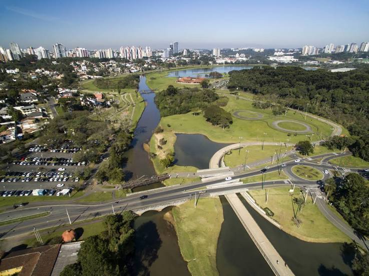
Curitiba
Curitiba Airport
Curitiba
Uberlândia — Curitiba distance, route on the map
Distance by car
Distance between Uberlândia, Minas Gerais, Brazil and Curitiba, State of Paraná, Brazil by car is — km, or miles. To travel this distance by car, you need minute, or h.
Route on the map, driving directions
Car route Uberlândia — Curitiba was created automatically. The road on the map is shown as a blue line. By moving the markers, you can create a new route through the points you need.
Passing cities through which the car route passes: Uru, Uberaba, Igarapava, Aramina, Ituverava, Guará, São Joaquim da Barra, São Joaquim da Barra, Orlândia, Sales Oliveira, Jardinópolis, Ribeirão Preto, Ribeirão Preto, São Carlos, Itirapina, São Paulo, Rio Claro, Santa Gertrudes, Iracemápolis, Piracicaba, Saltinho, Tietê, Tietê, Cerquilho, Alambari, Itapetininga, Itapetininga, Apiaí, Bocaiúva do Sul, Colombo, Curitiba, Curitiba Airport, Curitiba.
Distance by plane
If you decide to take a trip Uberlândia Curitiba by plane, then you have to fly the distance — 732 km or 454 miles. It is marked on the map with a gray line (between two points in a straight line).
Flight time
Estimated flight time Uberlândia Curitiba by plane at cruising speed 750 km / h will be — 58 min.
Direction of movement
Brazil, Uberlândia — right-hand traffic. Brazil, Curitiba — right-hand traffic.
Difference in time
Uberlândia and Curitiba are in the same time zone. Between them there is no time difference (UTC -3 America/Sao_Paulo).
Interesting Facts
Information on alternative ways to get to your destination.
The length of this distance is about 1.8% of the total length of the equator.
The percentage of the population is clearly shown in the graph:
Uberlândia — 563,536 (less by 1,154,897), Curitiba — 1,718,433 residents.
The cost of travel
Calculate the cost of the trip yourself using the fuel consumption calculator, changing the data in the table.