
 Servas
Saint-Bonnet-le-Troncy
Saint-Géry
Moncé-en-Belin
Maine-et-Loire
Noyant-la-Gravoyère
Brem-sur-Mer
Sainte-Foy-l'Argentière
Talmay
Paris
Saint-Maime
Le Bourg-d'Oisans
Milly
Mettray
Vierville
Naintré
Langeais
Auvillers-les-Forges
Orus
Servas
Saint-Bonnet-le-Troncy
Saint-Géry
Moncé-en-Belin
Maine-et-Loire
Noyant-la-Gravoyère
Brem-sur-Mer
Sainte-Foy-l'Argentière
Talmay
Paris
Saint-Maime
Le Bourg-d'Oisans
Milly
Mettray
Vierville
Naintré
Langeais
Auvillers-les-Forges
Orus
Les Pavillons-sous-Bois on the map, France
Where is located Les Pavillons-sous-Bois
Exact location — Les Pavillons-sous-Bois, Seine-Saint-Denis, Île-de-France, France, marked on the map with a red marker.
Coordinates
Les Pavillons-sous-Bois, France coordinates in decimal format: latitude — 48.90852, longitude — 2.504403. When converted to degrees, minutes, seconds Les Pavillons-sous-Bois has the following coordinates: 48°54′30.67 north latitude and 2°30′15.85 east longitude.
Population
Les Pavillons-sous-Bois, Seine-Saint-Denis, Île-de-France, France, according to our data the population is — 19,730 residents, which is about 0% of the total population of the country (France).
Comparison of the population on the graph:
Exact time
Time zone for this location Les Pavillons-sous-Bois — UTC +2 Europe/Paris. Exact time — sunday, 5 may 2024 year, 06 h. 57 minutes.
Sunrise and sunset
Les Pavillons-sous-Bois, sunrise and sunset data for a date — sunday 19.05.2024.
| Sunrise | Sunset | Day (duration) |
|---|---|---|
| 06:06 -1 minute | 21:26 +1 minute | 15 h. 18 minutes. +2 minutes |
You can control the scale of the map using the auxiliary tools to find out exactly where it is located Les Pavillons-sous-Bois. When you change the scale of the map, the width of the ruler also changes (in kilometers and miles).
Nearby cities
The largest cities that are located nearby:
- Boulogne-Billancourt — 21 km
- Amiens — 110 km
- Reims — 117 km
- Rouen — 117 km
- Orléans — 120 km
- Le Havre — 184 km
- Lille — 194 km
- Le Mans — 198 km
- Caen — 210 km
- Charleroi
 (Belgium) — 215 km
 - Tours — 216 km
- Namur (Belgium) — 240 km
- Brussels (Belgium) — 250 km
- Eastbourne
 (United Kingdom) — 257 km
 - Dijon — 259 km
- Metz — 267 km
- Nancy — 270 km
- Angers — 278 km
- Antwerp (Belgium) — 287 km
Distance to neighboring capitals:
- Brussels (Belgium) — 253 km
- London (United Kingdom) — 344 km
- Amsterdam
 (Netherlands) — 420 km
 - Bern
 (Switzerland) — 428 km
 - Vaduz
 (Liechtenstein) — 557 km
 - Andorra la Vella
 (Andorra) — 716 km
 - Berlin
 (Germany) — 865 km
 - Prague
 (Czech Republic) — 871 km
 - Copenhagen
 (Denmark) — 1016 km
 - Vienna
 (Austria) — 1023 km
 - Madrid
 (Spain) — 1064 km
 - Rome
 (Italy) — 1101 km
 - Warsaw
 (Poland) — 1354 km
 - Lisbon
 (Portugal) — 1465 km
 - Nicosia
 — 2942 km
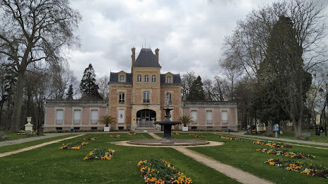
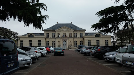
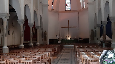
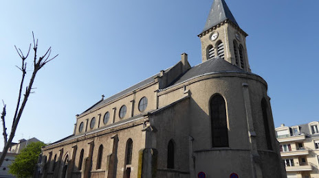
Attractions
Distance to the capital
Distance to the capital (Paris) is about — 13 km.