 La Cruz del Pastor
Cadereyta de Montes
Kabah
Basconcobe
Yabteclum
Tlaltenango
Agua Fresca
Coatepec
Zaragoza
Batopilas
Cunduacán
Rincón de Rubios
San Miguel Peras
San Antonio Huitepec
Bosques de Tres Marias
El Tule
Juan Escutia
Santiago
Noria
La Cruz del Pastor
Cadereyta de Montes
Kabah
Basconcobe
Yabteclum
Tlaltenango
Agua Fresca
Coatepec
Zaragoza
Batopilas
Cunduacán
Rincón de Rubios
San Miguel Peras
San Antonio Huitepec
Bosques de Tres Marias
El Tule
Juan Escutia
Santiago
Noria
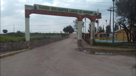
Zumpango on the map, Mexico
Where is located Zumpango
Exact location — Zumpango, Zumpango, State of Mexico, Mexico, marked on the map with a red marker.
Coordinates
Zumpango, Mexico coordinates in decimal format: latitude — 19.8039297, longitude — -99.0930528. When converted to degrees, minutes, seconds Zumpango has the following coordinates: 19°48′14.15 north latitude and -99°5′34.99 east longitude.
Exact time
Time zone for this location Zumpango — UTC -6 America/Mexico_City. Exact time — monday, 4 april 2024 year, 04 h. 33 minutes.
Sunrise and sunset
Zumpango, sunrise and sunset data for a date — monday 29.04.2024.
| Sunrise | Sunset | Day (duration) |
|---|---|---|
| 06:10 -1 minute | 18:56 -0 minutes | 12 h. 48 minutes. +1 minute |
You can control the scale of the map using the auxiliary tools to find out exactly where it is located Zumpango. When you change the scale of the map, the width of the ruler also changes (in kilometers and miles).
Nearby cities
The largest cities that are located nearby:
- Ojo de Agua — 15 km
- Coacalco — 19 km
- Ecatepec — 23 km
- Cuautitlán Izcalli — 24 km
- Buenavista — 24 km
- Tlalnepantla — 31 km
- Ciudad López Mateos — 33 km
- Naucalpan — 38 km
- Texcoco — 40 km
- Chimalhuacan — 44 km
- Ciudad Nezahualcóyotl — 46 km
- Pachuca — 48 km
- Ixtapaluca — 59 km
- Chalco de Díaz Covarrubias — 63 km
- Metepec — 81 km
- Tulancingo — 82 km
- Toluca — 82 km
- Cuernavaca — 98 km
- Jiutepec — 102 km
Distance to neighboring capitals:
- Guatemala City
 (Guatemala) — 1077 km
 - Belmopan
 (Belize) — 1125 km
 - Tegucigalpa
 (Honduras) — 1414 km
 - Washington
 (United States) — 2998 km
 - Saint John
 (Puerto Rico) — 3464 km
 - Ottawa
 (Canada) — 3567 km
 - Belgrade
 (Serbia) — 10588 km
 - Podgorica
 (Montenegro) — 10656 km
 - Hagåtña
 (Guam) — 12116 km
Attractions

Distance to the capital
Distance to the capital (Mexico City) is about — 42 km.