Tecámac de Felipe Villanueva — San Buenaventura
Tecámac de Felipe Villanueva — San Sebastian
Tecámac de Felipe Villanueva — San Rafael Río Seco
Tecámac de Felipe Villanueva — El Palmar
Tecámac de Felipe Villanueva — Ciudad de Cuetzalan
Tecámac de Felipe Villanueva — Vado Hondo
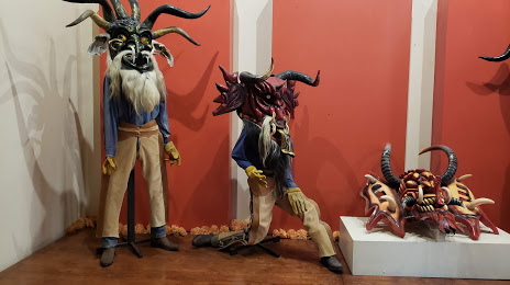
Tecámac de Felipe Villanueva — Ciudad Valles
Tecámac de Felipe Villanueva — Tetiz Municipality
Tecámac de Felipe Villanueva — Dzitbalché
Tecámac de Felipe Villanueva — Batamote
Tecámac de Felipe Villanueva — San Mateo Mexicaltzingo
Tecámac de Felipe Villanueva — Barretal
Tecámac de Felipe Villanueva — Los Órganos
Tecámac de Felipe Villanueva — Saint Vincent
Tecámac de Felipe Villanueva — Ignacio Zaragoza
Tecámac de Felipe Villanueva — Duarte
Tecámac de Felipe Villanueva — Coacalco de Berriozábal
Tecámac de Felipe Villanueva — Villa Juarez
Tecámac de Felipe Villanueva — Mazatán
Tecámac de Felipe Villanueva — San Buenaventura
Tecámac de Felipe Villanueva — San Sebastian
Tecámac de Felipe Villanueva — San Rafael Río Seco
Tecámac de Felipe Villanueva — El Palmar
Tecámac de Felipe Villanueva — Ciudad de Cuetzalan
Tecámac de Felipe Villanueva — Vado Hondo
Tecámac de Felipe Villanueva — Ciudad Valles
Tecámac de Felipe Villanueva — Tetiz Municipality
Tecámac de Felipe Villanueva — Dzitbalché
Tecámac de Felipe Villanueva — Batamote
Tecámac de Felipe Villanueva — San Mateo Mexicaltzingo
Tecámac de Felipe Villanueva — Barretal
Tecámac de Felipe Villanueva — Los Órganos
Tecámac de Felipe Villanueva — Saint Vincent
Tecámac de Felipe Villanueva — Ignacio Zaragoza
Tecámac de Felipe Villanueva — Duarte
Tecámac de Felipe Villanueva — Coacalco de Berriozábal
Tecámac de Felipe Villanueva — Villa Juarez
Tecámac de Felipe Villanueva — Mazatán
Tecámac de Felipe Villanueva — San Luis Potosi distance, route on the map
Distance by car
Distance between Tecámac de Felipe Villanueva, Estado de México, Mexico and San Luis Potosi, San Luis Potosi, Mexico by car is — km, or miles. To travel this distance by car, you need minute, or h.
Route on the map, driving directions
Car route Tecámac de Felipe Villanueva — San Luis Potosi was created automatically. The road on the map is shown as a blue line. By moving the markers, you can create a new route through the points you need.
Distance by plane
If you decide to take a trip Tecámac de Felipe Villanueva San Luis Potosi by plane, then you have to fly the distance — 344 km or 213 miles. It is marked on the map with a gray line (between two points in a straight line).
Flight time
Estimated flight time Tecámac de Felipe Villanueva San Luis Potosi by plane at cruising speed 750 km / h will be — 27 min.
Direction of movement
Mexico, Tecámac de Felipe Villanueva — right-hand traffic. Mexico, San Luis Potosi — right-hand traffic.
Difference in time
Tecámac de Felipe Villanueva and San Luis Potosi are in the same time zone. Between them there is no time difference (UTC -6 America/Mexico_City).
Interesting Facts
Information on alternative ways to get to your destination.
The length of this distance is about 0.9% of the total length of the equator.
The percentage of the population is clearly shown in the graph:
Tecámac de Felipe Villanueva — 15,244 (less by 662,482), San Luis Potosi — 677,726 residents.
The cost of travel
Calculate the cost of the trip yourself using the fuel consumption calculator, changing the data in the table.