 San Jose
San Benito County
Shelby County
Marianne
New York
Edna
Milwaukee
Alexander County
Money
Green
Medina County
Ohero Airport's Terminal3
Carville
Lowell
Florida
Park Hills
Lux
Robertson County
Sutherland
San Jose
San Benito County
Shelby County
Marianne
New York
Edna
Milwaukee
Alexander County
Money
Green
Medina County
Ohero Airport's Terminal3
Carville
Lowell
Florida
Park Hills
Lux
Robertson County
Sutherland
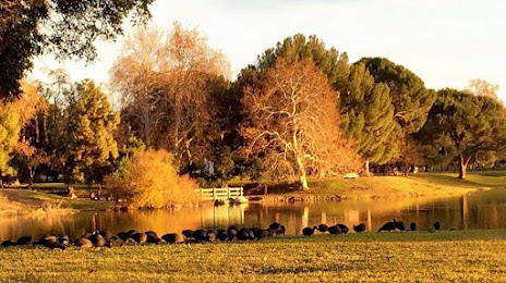
Avocado Heights on the map, United States
Where is located Avocado Heights
Exact location — Avocado Heights, Los Angeles County, California, United States, marked on the map with a red marker.
Coordinates
Avocado Heights, United States coordinates in decimal format: latitude — 34.0361217, longitude — -117.9911765. When converted to degrees, minutes, seconds Avocado Heights has the following coordinates: 34°2′10.04 north latitude and -117°59′28.24 east longitude.
Population
Avocado Heights, Los Angeles County, California, United States, according to our data the population is — 15,411 residents, which is about 0% of the total population of the country (United States).
Comparison of the population on the graph:
Exact time
Time zone for this location Avocado Heights — UTC -7 America/Los_Angeles. Exact time — thursday, 4 april 2024 year, 20 h. 13 minutes.
Sunrise and sunset
Avocado Heights, sunrise and sunset data for a date — thursday 25.04.2024.
| Sunrise | Sunset | Day (duration) |
|---|---|---|
| 06:10 -2 minutes | 19:28 +1 minute | 13 h. 18 minutes. +3 minutes |
You can control the scale of the map using the auxiliary tools to find out exactly where it is located Avocado Heights. When you change the scale of the map, the width of the ruler also changes (in kilometers and miles).
Nearby cities
The largest cities that are located nearby:
- El Monte — 5 km
- West Covina — 6 km
- East Los Angeles — 16 km
- Downey — 17 km
- Norwalk — 17 km
- Pasadena — 19 km
- Fullerton — 19 km
- Pomona — 22 km
- Los Angeles — 23 km
- Anaheim — 23 km
- Glendale — 27 km
- Garden Grove — 29 km
- Orange — 30 km
- Ontario — 31 km
- Burbank — 33 km
- Santa Ana — 34 km
- Inglewood — 34 km
- Long Beach — 35 km
- Universal City — 35 km
Distance to neighboring capitals:
- Mexico City
 (Mexico) — 2471 km
 - Belmopan
 (Belize) — 3454 km
 - Guatemala City
 (Guatemala) — 3502 km
 - Ottawa
 (Canada) — 3783 km
 - Nuuk
 (Greenland) — 5508 km
Attractions

Distance to the capital
Distance to the capital (Washington) is about — 3672 km.