Mogi Mirim — Pomerode
Mogi Mirim — Piedade
Mogi Mirim — Rio Vermelho
Mogi Mirim — Armação dos Búzios
Mogi Mirim — Água Boa
Mogi Mirim — Fortaleza dos Nogueiras
Mogi Mirim — Laurinha
Mogi Mirim — Casa Branca
Mogi Mirim — Campo do Brito
Mogi Mirim — Moju
Mogi Mirim — Rafael Jambeiro
Mogi Mirim — Lavrinhas
Mogi Mirim — Pocinhos
Mogi Mirim — Maringá
Mogi Mirim — Vermelho Novo
Mogi Mirim — Coronel Macedo
Mogi Mirim — Capela
Mogi Mirim — Paranacity
Mogi Mirim — Tibau
Itapira
Jacutinga
Ouro Fino
Inconfidentes
Borda da Mata
Hill Santa Barbara
Pouso Alegre
São Sebastião da Bela Vista
Campanha
Três Corações
Carmo da Cachoeira
Carmo da Cachoeira
Santo Antônio do Amparo
Oliveira
Oliveira
Itatiaiuçu
Igarapé
São Joaquim de Bicas
Betim
Contagem
Ribeirão das Neves
Ribeirão das Neves
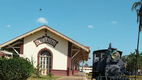
Mogi Mirim — Sete Lagoas distance, route on the map
Distance by car
Distance between Mogi Mirim, State of São Paulo, Brazil and Sete Lagoas, Minas Gerais, Brazil by car is — km, or miles. To travel this distance by car, you need minute, or h.
Route on the map, driving directions
Car route Mogi Mirim — Sete Lagoas was created automatically. The road on the map is shown as a blue line. By moving the markers, you can create a new route through the points you need.
Passing cities through which the car route passes: Mogi Mirim, Itapira, Jacutinga, Ouro Fino, Inconfidentes, Borda da Mata, Hill Santa Barbara, Pouso Alegre, São Sebastião da Bela Vista, Campanha, Três Corações, Carmo da Cachoeira, Carmo da Cachoeira, Santo Antônio do Amparo, Oliveira, Oliveira, Itatiaiuçu, Igarapé, São Joaquim de Bicas, Betim, Contagem, Ribeirão das Neves, Ribeirão das Neves.
Distance by plane
If you decide to take a trip Mogi Mirim Sete Lagoas by plane, then you have to fly the distance — 441 km or 273 miles. It is marked on the map with a gray line (between two points in a straight line).
Flight time
Estimated flight time Mogi Mirim Sete Lagoas by plane at cruising speed 750 km / h will be — 35 min.
Direction of movement
Brazil, Mogi Mirim — right-hand traffic. Brazil, Sete Lagoas — right-hand traffic.
Difference in time
Mogi Mirim and Sete Lagoas are in the same time zone. Between them there is no time difference (UTC -3 America/Sao_Paulo).
Interesting Facts
Information on alternative ways to get to your destination.
The length of this distance is about 1.1% of the total length of the equator.
The percentage of the population is clearly shown in the graph:
Mogi Mirim — 78,244 (less by 123,090), Sete Lagoas — 201,334 residents.
The cost of travel
Calculate the cost of the trip yourself using the fuel consumption calculator, changing the data in the table.