 Telchac Pueblo
Oaxaca
El Tunal
Venado
Huehuetán
Coscomatepec de Bravo
Tepatlaxco de Hidalgo
Tepatlaxco
José María Pino Suárez
Purépero
Chignahuapan
San Juan del Río
Navarrete
La Compañia
Carlos A. Madrazo
Ocampo
Hacienda del Carmen
Boca de Pascuales
El Coyolar
Telchac Pueblo
Oaxaca
El Tunal
Venado
Huehuetán
Coscomatepec de Bravo
Tepatlaxco de Hidalgo
Tepatlaxco
José María Pino Suárez
Purépero
Chignahuapan
San Juan del Río
Navarrete
La Compañia
Carlos A. Madrazo
Ocampo
Hacienda del Carmen
Boca de Pascuales
El Coyolar
Xico on the map, Mexico
Where is located Xico
Exact location — Xico, Veracruz, Mexico, marked on the map with a red marker.
Coordinates
Xico, Mexico coordinates in decimal format: latitude — 19.4247826, longitude — -97.0041525. When converted to degrees, minutes, seconds Xico has the following coordinates: 19°25′29.22 north latitude and -97°0′14.95 east longitude.
Population
Xico, Veracruz, Mexico, according to our data the population is — 15,292 residents, which is about 0% of the total population of the country (Mexico).
Comparison of the population on the graph:
Exact time
Time zone for this location Xico — UTC -6 America/Mexico_City. Exact time — sunday, 4 april 2024 year, 15 h. 07 minutes.
Sunrise and sunset
Xico, sunrise and sunset data for a date — sunday 28.04.2024.
| Sunrise | Sunset | Day (duration) |
|---|---|---|
| 06:03 -0 minutes | 18:47 -0 minutes | 12 h. 42 minutes. -0 minutes |
You can control the scale of the map using the auxiliary tools to find out exactly where it is located Xico. When you change the scale of the map, the width of the ruler also changes (in kilometers and miles).
Nearby cities
The largest cities that are located nearby:
- Xalapa — 16 km
- Córdoba — 60 km
- Orizaba — 64 km
- Martínez de la Torre — 71 km
- Tehuacán — 114 km
- Poza Rica de Hidalgo — 131 km
- Puebla — 133 km
- Tulancingo — 159 km
- Texcoco — 196 km
- Ixtapaluca — 196 km
- Pachuca — 197 km
- Chalco de Díaz Covarrubias — 198 km
- Chimalhuacan — 204 km
- Ciudad Nezahualcóyotl — 207 km
- Ojo de Agua — 213 km
- Ecatepec — 214 km
- Cuautla — 215 km
- Coacalco — 220 km
- Buenavista — 227 km
Distance to neighboring capitals:
- Guatemala City
 (Guatemala) — 871 km
 - Belmopan
 (Belize) — 903 km
 - Tegucigalpa
 (Honduras) — 1199 km
 - Washington
 (United States) — 2894 km
 - Saint John
 (Puerto Rico) — 3248 km
 - Ottawa
 (Canada) — 3492 km
 - Belgrade
 (Serbia) — 10484 km
 - Podgorica
 (Montenegro) — 10544 km
 - Hagåtña
 (Guam) — 12334 km
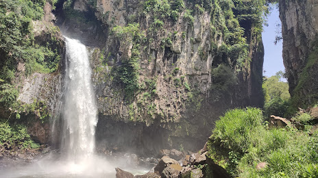
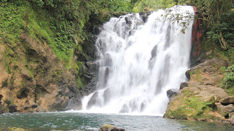
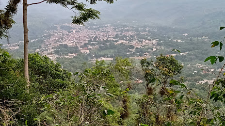
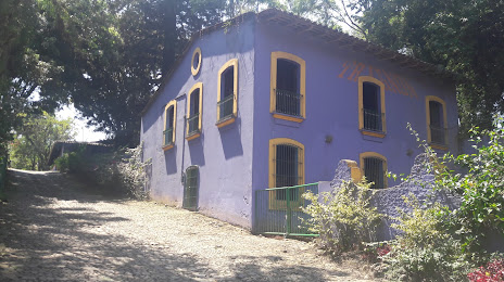
Attractions
Distance to the capital
Distance to the capital (Mexico City) is about — 223 km.