San Pedro Las Huertas — Carrizal
San Pedro Las Huertas — Monterrico
San Pedro Las Huertas — Chiché
San Pedro Las Huertas — Guatemala City
San Pedro Las Huertas — Retalhuleu
San Pedro Las Huertas — San Gabriel
San Pedro Las Huertas — Pachali
San Pedro Las Huertas — Izabal Department
San Pedro Las Huertas — San Pablo La Laguna
San Pedro Las Huertas — Cuyuta
San Pedro Las Huertas — Rubelsanto
San Pedro Las Huertas — Rancho Viejo
San Pedro Las Huertas — San Lucas Tolimán
San Pedro Las Huertas — Palqui
San Pedro Las Huertas — Livingston
San Pedro Las Huertas — San Antonio Huista
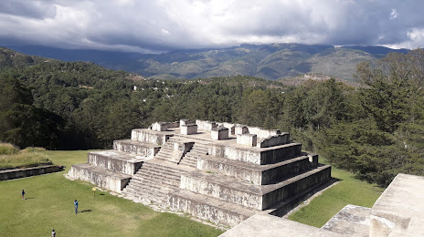
San Pedro Las Huertas — Tikal
San Pedro Las Huertas — Palestina de los Altos
San Pedro Las Huertas — Dolores
Pastores
San Luis Pueblo Nuevo
Parramos
Chimaltenango
San Andrés Itzapa
Zaragoza
Patzicía
Santa Cruz Balanyá
Tekpan
Santa Apolonia
Tzanimacabaj
The meetings
Chaquijya
San Juan Argueta
St. Lucia Utatlán
Nahuala
Santa Catarina Ixtahuacan
Cantel
Salcajá
Cuatro Caminos
San Cristóbal Totonicapán
San Francisco El Alto
Pologua
San Bartolo
Malacatancito
San Lorenzo
Huehuetenango
San Pedro Las Huertas — Carrizal
San Pedro Las Huertas — Monterrico
San Pedro Las Huertas — Chiché
San Pedro Las Huertas — Guatemala City
San Pedro Las Huertas — Retalhuleu
San Pedro Las Huertas — San Gabriel
San Pedro Las Huertas — Pachali
San Pedro Las Huertas — Izabal Department
San Pedro Las Huertas — San Pablo La Laguna
San Pedro Las Huertas — Cuyuta
San Pedro Las Huertas — Rubelsanto
San Pedro Las Huertas — Rancho Viejo
San Pedro Las Huertas — San Lucas Tolimán
San Pedro Las Huertas — Palqui
San Pedro Las Huertas — Livingston
San Pedro Las Huertas — San Antonio Huista
San Pedro Las Huertas — Tikal
San Pedro Las Huertas — Palestina de los Altos
San Pedro Las Huertas — Dolores
Pastores
San Luis Pueblo Nuevo
Parramos
Chimaltenango
San Andrés Itzapa
Zaragoza
Patzicía
Santa Cruz Balanyá
Tekpan
Santa Apolonia
Tzanimacabaj
The meetings
Chaquijya
San Juan Argueta
St. Lucia Utatlán
Nahuala
Santa Catarina Ixtahuacan
Cantel
Salcajá
Cuatro Caminos
San Cristóbal Totonicapán
San Francisco El Alto
Pologua
San Bartolo
Malacatancito
San Lorenzo
Huehuetenango
San Pedro Las Huertas — Huehuetenango distance, route on the map
Distance by car
Distance between San Pedro Las Huertas, Sacatepéquez, Guatemala and Huehuetenango, Huehuetenango, Guatemala by car is — km, or miles. To travel this distance by car, you need minute, or h.
Route on the map, driving directions
Car route San Pedro Las Huertas — Huehuetenango was created automatically. The road on the map is shown as a blue line. By moving the markers, you can create a new route through the points you need.
Passing cities through which the car route passes: Colonia Los Llanos, Pastores, San Luis Pueblo Nuevo, Parramos, Chimaltenango, San Andrés Itzapa, Zaragoza, Patzicía, Santa Cruz Balanyá, Tekpan, Santa Apolonia, Tzanimacabaj, The meetings, Chaquijya, San Juan Argueta, St. Lucia Utatlán, Nahuala, Santa Catarina Ixtahuacan, Cantel, Salcajá, Cuatro Caminos, San Cristóbal Totonicapán, San Francisco El Alto, Pologua, San Bartolo, Malacatancito, San Lorenzo, Huehuetenango.
Distance by plane
If you decide to take a trip San Pedro Las Huertas Huehuetenango by plane, then you have to fly the distance — 119 km or 74 miles. It is marked on the map with a gray line (between two points in a straight line).
Flight time
Estimated flight time San Pedro Las Huertas Huehuetenango by plane at cruising speed 750 km / h will be — 9 min.
Direction of movement
Guatemala, San Pedro Las Huertas — right-hand traffic. Guatemala, Huehuetenango — right-hand traffic.
Difference in time
San Pedro Las Huertas and Huehuetenango are in the same time zone. Between them there is no time difference (UTC -6 America/Guatemala).
Interesting Facts
Information on alternative ways to get to your destination.
The length of this distance is about 0.3% of the total length of the equator.
The cost of travel
Calculate the cost of the trip yourself using the fuel consumption calculator, changing the data in the table.