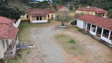
São José dos Pinhais — Brejo
São José dos Pinhais — Casa Nova
São José dos Pinhais — Cruzeiro
São José dos Pinhais — Vargem Grande
São José dos Pinhais — Carvalhos
São José dos Pinhais — Jateí
São José dos Pinhais — Tefé
São José dos Pinhais — Alterosa
São José dos Pinhais — Feira Nova
São José dos Pinhais — Santa Branca
São José dos Pinhais — Salitre de Minas
São José dos Pinhais — Juazeiro do Norte
São José dos Pinhais — Borborema
São José dos Pinhais — Olho d'Água das Flores
São José dos Pinhais — Buritirana
São José dos Pinhais — Itatiaiuçu
São José dos Pinhais — Barra do Rio Azul
São José dos Pinhais — Bom Princípio
São José dos Pinhais — Roque Gonzales
Quatro Barras
Campina Grande do Sul
Cajati
Registro
Miracatu
Juquitiba
São Lourenço da Serra
Embu das Artes
Taboão da Serra
Pestana
Carapicuiba
Rochdale
Caieiras
São José dos Pinhais — Franco da Rocha distance, route on the map
Distance by car
Distance between São José dos Pinhais, Paraná, Brazil and Franco da Rocha, State of São Paulo, Brazil by car is — km, or miles. To travel this distance by car, you need minute, or h.
Route on the map, driving directions
Car route São José dos Pinhais — Franco da Rocha was created automatically. The road on the map is shown as a blue line. By moving the markers, you can create a new route through the points you need.
Passing cities through which the car route passes: Piraquara, Quatro Barras, Campina Grande do Sul, Cajati, Registro, Miracatu, Juquitiba, São Lourenço da Serra, Embu das Artes, Taboão da Serra, Pestana, Carapicuiba, Rochdale, Caieiras.
Distance by plane
If you decide to take a trip São José dos Pinhais Franco da Rocha by plane, then you have to fly the distance — 351 km or 218 miles. It is marked on the map with a gray line (between two points in a straight line).
Flight time
Estimated flight time São José dos Pinhais Franco da Rocha by plane at cruising speed 750 km / h will be — 28 min.
Direction of movement
Brazil, São José dos Pinhais — right-hand traffic. Brazil, Franco da Rocha — right-hand traffic.
Difference in time
São José dos Pinhais and Franco da Rocha are in the same time zone. Between them there is no time difference (UTC -3 America/Sao_Paulo).
Interesting Facts
Information on alternative ways to get to your destination.
The length of this distance is about 0.9% of the total length of the equator.
The percentage of the population is clearly shown in the graph:
São José dos Pinhais — 229,988, Franco da Rocha — 108,858 residents (less by 121,130).
The cost of travel
Calculate the cost of the trip yourself using the fuel consumption calculator, changing the data in the table.