 Aluta
Kiln
Dundalk
Cambridge
Greenwood
Crane County
Venice
Ashton
Flemington
Heil
Brighton
Bolivar
Deaf Smith County
Montague
Knapp
Bray
Stab
Zion
Indiana
Aluta
Kiln
Dundalk
Cambridge
Greenwood
Crane County
Venice
Ashton
Flemington
Heil
Brighton
Bolivar
Deaf Smith County
Montague
Knapp
Bray
Stab
Zion
Indiana
Middleburg on the map, United States
Where is located Middleburg
Exact location — Middleburg, Florida, United States, marked on the map with a red marker.
Coordinates
Middleburg, United States coordinates in decimal format: latitude — 30.0968432, longitude — -81.8133347. When converted to degrees, minutes, seconds Middleburg has the following coordinates: 30°5′48.64 north latitude and -81°48′48 east longitude.
Population
Middleburg, Florida, United States, according to our data the population is — 13,008 residents, which is about 0% of the total population of the country (United States).
Comparison of the population on the graph:
Exact time
Time zone for this location Middleburg — UTC -4 America/New_York. Exact time — monday, 4 april 2024 year, 01 h. 45 minutes.
Sunrise and sunset
Middleburg, sunrise and sunset data for a date — monday 29.04.2024.
| Sunrise | Sunset | Day (duration) |
|---|---|---|
| 06:48 -0 minutes | 20:00 -0 minutes | 13 h. 12 minutes. -0 minutes |
You can control the scale of the map using the auxiliary tools to find out exactly where it is located Middleburg. When you change the scale of the map, the width of the ruler also changes (in kilometers and miles).
Nearby cities
The largest cities that are located nearby:
- Jacksonville — 30 km
- Gainesville — 70 km
- Orlando — 177 km
- Savannah — 230 km
- Tallahassee — 238 km
- Brandon — 243 km
- Tampa — 245 km
- Clearwater — 255 km
- Saint Petersburg — 269 km
- Port Saint Lucie — 343 km
- Charleston — 344 km
- Cape Coral — 391 km
- Columbia — 437 km
- Coral Springs — 450 km
- Atlanta — 468 km
- Fort Lauderdale — 470 km
- Pembroke Pines — 477 km
- Miramar — 479 km
- Hollywood — 481 km
Distance to neighboring capitals:
- Belmopan
 (Belize) — 1594 km
 - Ottawa
 (Canada) — 1786 km
 - Guatemala City
 (Guatemala) — 1940 km
 - Mexico City
 (Mexico) — 2109 km
 - Nuuk
 (Greenland) — 4334 km
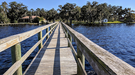
Attractions


Distance to the capital
Distance to the capital (Washington) is about — 1073 km.