Ribeirão Preto — Lindóia do Sul
Ribeirão Preto — Santana de Parnaíba
Ribeirão Preto — Lapa
Ribeirão Preto — Salto Grande
Ribeirão Preto — Mato Grosso
Ribeirão Preto — Carapina
Ribeirão Preto — Naque
Ribeirão Preto — São Gabriel
Ribeirão Preto — Pindorama
Ribeirão Preto — Monte Mor
Ribeirão Preto — Aljubarrota
Ribeirão Preto — Vermelho Novo
Ribeirão Preto — Caetité
Ribeirão Preto — Frutal
Ribeirão Preto — Cachoeira Alta
Ribeirão Preto — Acajutiba
Ribeirão Preto — Amparo
Ribeirão Preto — Acopiara
Ribeirão Preto — Cantá
Sales Oliveira
Orlândia
São Joaquim da Barra
São Joaquim da Barra
Guará
Ituverava
Aramina
Igarapava
Uberaba
Uru
Uberlândia
Araguari
Catalão
Cristalina
Formosa
Vila Boa
Posse
Barreiras
Formosa do Rio Preto
Floriano
Amarante
São Pedro do Piauí
Água Branca
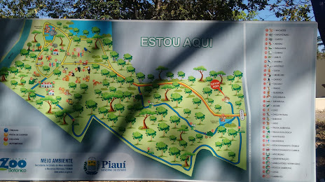
Teresina
Ribeirão Preto — Lindóia do Sul
Ribeirão Preto — Santana de Parnaíba
Ribeirão Preto — Lapa
Ribeirão Preto — Salto Grande
Ribeirão Preto — Mato Grosso
Ribeirão Preto — Carapina
Ribeirão Preto — Naque
Ribeirão Preto — São Gabriel
Ribeirão Preto — Pindorama
Ribeirão Preto — Monte Mor
Ribeirão Preto — Aljubarrota
Ribeirão Preto — Vermelho Novo
Ribeirão Preto — Caetité
Ribeirão Preto — Frutal
Ribeirão Preto — Cachoeira Alta
Ribeirão Preto — Acajutiba
Ribeirão Preto — Amparo
Ribeirão Preto — Acopiara
Ribeirão Preto — Cantá
Sales Oliveira
Orlândia
São Joaquim da Barra
São Joaquim da Barra
Guará
Ituverava
Aramina
Igarapava
Uberaba
Uru
Uberlândia
Araguari
Catalão
Cristalina
Formosa
Vila Boa
Posse
Barreiras
Formosa do Rio Preto
Floriano
Amarante
São Pedro do Piauí
Água Branca
Teresina
Ribeirão Preto — Teresina distance, route on the map
Distance by car
Distance between Ribeirão Preto, São Paulo, Brazil and Teresina, State of Piauí, Brazil by car is — km, or miles. To travel this distance by car, you need minute, or h.
Route on the map, driving directions
Car route Ribeirão Preto — Teresina was created automatically. The road on the map is shown as a blue line. By moving the markers, you can create a new route through the points you need.
Passing cities through which the car route passes: Jardinópolis, Sales Oliveira, Orlândia, São Joaquim da Barra, São Joaquim da Barra, Guará, Ituverava, Aramina, Igarapava, Uberaba, Uru, Uberlândia, Araguari, Catalão, Cristalina, Formosa, Vila Boa, Posse, Barreiras, Formosa do Rio Preto, Floriano, Amarante, São Pedro do Piauí, Água Branca, Teresina.
Distance by plane
If you decide to take a trip Ribeirão Preto Teresina by plane, then you have to fly the distance — 1870 km or 1159 miles. It is marked on the map with a gray line (between two points in a straight line).
Flight time
Estimated flight time Ribeirão Preto Teresina by plane at cruising speed 750 km / h will be — 2 h. and 29 min.
Direction of movement
Brazil, Ribeirão Preto — right-hand traffic. Brazil, Teresina — right-hand traffic.
Difference in time
Ribeirão Preto and Teresina are in the same time zone. Between them there is no time difference (UTC -3 America/Sao_Paulo).
Interesting Facts
Information on alternative ways to get to your destination.
The length of this distance is about 4.7% of the total length of the equator.
The cost of travel
Calculate the cost of the trip yourself using the fuel consumption calculator, changing the data in the table.