São Mateus — Manaus
São Mateus — São José
São Mateus — Itapevi
São Mateus — Acopiara
São Mateus — Bagé
São Mateus — Passo do Sobrado
São Mateus — Encruzilhada do Sul
São Mateus — Quirinópolis
São Mateus — Rio Manso
São Mateus — Araçoiaba da Serra
São Mateus — Jaguaruna
São Mateus — Abadiânia
São Mateus — Satuba
São Mateus — Viadutos
São Mateus — Capão Alto
São Mateus — Porto Mauá
São Mateus — Bragança
São Mateus — Alto Rio Novo
São Mateus — Miranda
Barra de São Francisco
Central de Minas
Valadares Governor
Naque
Ipaba
Santana do Paraíso
Ipatinga
Coronel Fabriciano
Timóteo
Nova Era
João Monlevade
Nova União
Sabará
Jaraguá
Belo Horizonte/Pampulha–Carlos Drummond de Andrade Airport
Santa Luzia
Vespasiano
Tancredo Neves International Airport
Confins
Pedro Leopoldo
Matozinhos
Capim Branco
Prudente de Morais
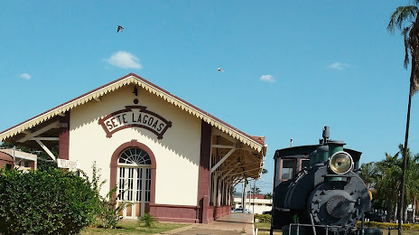
São Mateus — Sete Lagoas distance, route on the map
Distance by car
Distance between São Mateus, Espírito Santo, Brazil and Sete Lagoas, Minas Gerais, Brazil by car is — km, or miles. To travel this distance by car, you need minute, or h.
Route on the map, driving directions
Car route São Mateus — Sete Lagoas was created automatically. The road on the map is shown as a blue line. By moving the markers, you can create a new route through the points you need.
Passing cities through which the car route passes: Nova Venécia, Barra de São Francisco, Central de Minas, Valadares Governor, Naque, Ipaba, Santana do Paraíso, Ipatinga, Coronel Fabriciano, Timóteo, Nova Era, João Monlevade, Nova União, Sabará, Jaraguá, Belo Horizonte/Pampulha–Carlos Drummond de Andrade Airport, Santa Luzia, Vespasiano, Tancredo Neves International Airport, Confins, Pedro Leopoldo, Matozinhos, Capim Branco, Prudente de Morais.
Distance by plane
If you decide to take a trip São Mateus Sete Lagoas by plane, then you have to fly the distance — 468 km or 290 miles. It is marked on the map with a gray line (between two points in a straight line).
Flight time
Estimated flight time São Mateus Sete Lagoas by plane at cruising speed 750 km / h will be — 37 min.
Direction of movement
Brazil, São Mateus — right-hand traffic. Brazil, Sete Lagoas — right-hand traffic.
Difference in time
São Mateus and Sete Lagoas are in the same time zone. Between them there is no time difference (UTC -3 America/Sao_Paulo).
Interesting Facts
Information on alternative ways to get to your destination.
The length of this distance is about 1.2% of the total length of the equator.
The percentage of the population is clearly shown in the graph:
São Mateus — 77,119 (less by 124,215), Sete Lagoas — 201,334 residents.
The cost of travel
Calculate the cost of the trip yourself using the fuel consumption calculator, changing the data in the table.