Puente de Ixtla — Las Esmeraldas
Puente de Ixtla — Viborillas
Puente de Ixtla — Jalcocotán
Puente de Ixtla — Yauhquemecan
Puente de Ixtla — Hidalgo
Puente de Ixtla — Muxupip
Puente de Ixtla — Jiménez
Puente de Ixtla — Atlacomulco
Puente de Ixtla — Villa del Carbón
Puente de Ixtla — Santa María del Río
Puente de Ixtla — Trincheras
Puente de Ixtla — Ayutla Mixes
Puente de Ixtla — Feliciano
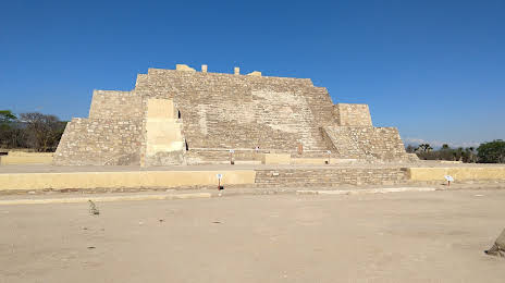
Puente de Ixtla — Chichen Itza
Puente de Ixtla — San Lorenzo Cacaotepec
Puente de Ixtla — Oquitoa
Puente de Ixtla — Taray
Puente de Ixtla — San Bartolo Coyotepec
Puente de Ixtla — Mexico City
Tequesquitengo
Nicolás Bravo
Zacatepec de Hidalgo
Jojutla
Jojutla
Tlaquiltenango
Tlaltizapán
Morelos
Ciudad Ayala
Ciudad Ayala
Cuautla
Huexca
Xalostoc
Amayuca
Jantetelco
Temoac
Tochimilco
Atlixco
Atlixco
Chipilo
Tlaxcalancingo
Puebla City
Real del Monte
Puebla
San Pablo del Monte
Tepatlaxco de Hidalgo
Tepeaca
Acatzingo
Quecholac
Palmarito Tochapan
Tepanco
Puente de Ixtla — Las Esmeraldas
Puente de Ixtla — Viborillas
Puente de Ixtla — Jalcocotán
Puente de Ixtla — Yauhquemecan
Puente de Ixtla — Hidalgo
Puente de Ixtla — Muxupip
Puente de Ixtla — Jiménez
Puente de Ixtla — Atlacomulco
Puente de Ixtla — Villa del Carbón
Puente de Ixtla — Santa María del Río
Puente de Ixtla — Trincheras
Puente de Ixtla — Ayutla Mixes
Puente de Ixtla — Feliciano
Puente de Ixtla — Chichen Itza
Puente de Ixtla — San Lorenzo Cacaotepec
Puente de Ixtla — Oquitoa
Puente de Ixtla — Taray
Puente de Ixtla — San Bartolo Coyotepec
Puente de Ixtla — Mexico City
Tequesquitengo
Nicolás Bravo
Zacatepec de Hidalgo
Jojutla
Jojutla
Tlaquiltenango
Tlaltizapán
Morelos
Ciudad Ayala
Ciudad Ayala
Cuautla
Huexca
Xalostoc
Amayuca
Jantetelco
Temoac
Tochimilco
Atlixco
Atlixco
Chipilo
Tlaxcalancingo
Puebla City
Real del Monte
Puebla
San Pablo del Monte
Tepatlaxco de Hidalgo
Tepeaca
Acatzingo
Quecholac
Palmarito Tochapan
Tepanco
Puente de Ixtla — Tehuacán distance, route on the map
Distance by car
Distance between Puente de Ixtla, Morelos, Mexico and Tehuacán, Puebla, Mexico by car is — km, or miles. To travel this distance by car, you need minute, or h.
Route on the map, driving directions
Car route Puente de Ixtla — Tehuacán was created automatically. The road on the map is shown as a blue line. By moving the markers, you can create a new route through the points you need.
Passing cities through which the car route passes: Ahuehuetzingo, Tequesquitengo, Nicolás Bravo, Zacatepec de Hidalgo, Jojutla, Jojutla, Tlaquiltenango, Tlaltizapán, Morelos, Ciudad Ayala, Ciudad Ayala, Cuautla, Huexca, Xalostoc, Amayuca, Jantetelco, Temoac, Tochimilco, Atlixco, Atlixco, Chipilo, Tlaxcalancingo, Puebla City, Real del Monte, Puebla, San Pablo del Monte, Tepatlaxco de Hidalgo, Tepeaca, Acatzingo, Quecholac, Palmarito Tochapan, Tepanco.
Distance by plane
If you decide to take a trip Puente de Ixtla Tehuacán by plane, then you have to fly the distance — 204 km or 126 miles. It is marked on the map with a gray line (between two points in a straight line).
Flight time
Estimated flight time Puente de Ixtla Tehuacán by plane at cruising speed 750 km / h will be — 16 min.
Direction of movement
Mexico, Puente de Ixtla — right-hand traffic. Mexico, Tehuacán — right-hand traffic.
Difference in time
Puente de Ixtla and Tehuacán are in the same time zone. Between them there is no time difference (UTC -6 America/Mexico_City).
Interesting Facts
Information on alternative ways to get to your destination.
The length of this distance is about 0.5% of the total length of the equator.
The percentage of the population is clearly shown in the graph:
Puente de Ixtla — 20,668 (less by 220,769), Tehuacán — 241,437 residents.
The cost of travel
Calculate the cost of the trip yourself using the fuel consumption calculator, changing the data in the table.