
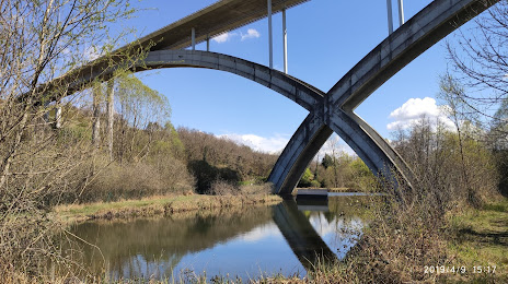
 Montferrand-le-Château
Breteuil
Vernouillet
Saint-Paul-en-Gâtine
Saint-Berthevin
Thuré
Dampierre-en-Yvelines
Dampierre
La Roque-Baignard
Manin
Arbanats
Saint-Hellier
Herserange
Saint-Pierre-en-Port
Foulbec
Fanlac
Verel-de-Montbel
Chimilin
Le Bosc
Montferrand-le-Château
Breteuil
Vernouillet
Saint-Paul-en-Gâtine
Saint-Berthevin
Thuré
Dampierre-en-Yvelines
Dampierre
La Roque-Baignard
Manin
Arbanats
Saint-Hellier
Herserange
Saint-Pierre-en-Port
Foulbec
Fanlac
Verel-de-Montbel
Chimilin
Le Bosc
Soyaux on the map, France
Where is located Soyaux
Exact location — Soyaux, Charente, Nouvelle-Aquitaine, France, marked on the map with a red marker.
Coordinates
Soyaux, France coordinates in decimal format: latitude — 45.641437, longitude — 0.192981. When converted to degrees, minutes, seconds Soyaux has the following coordinates: 45°38′29.17 north latitude and 0°11′34.73 east longitude.
Population
Soyaux, Charente, Nouvelle-Aquitaine, France, according to our data the population is — 11,220 residents, which is about 0% of the total population of the country (France).
Comparison of the population on the graph:
Exact time
Time zone for this location Soyaux — UTC +2 Europe/Paris. Exact time — wednesday, 5 may 2024 year, 02 h. 06 minutes.
Sunrise and sunset
Soyaux, sunrise and sunset data for a date — wednesday 15.05.2024.
| Sunrise | Sunset | Day (duration) |
|---|---|---|
| 06:31 -1 minute | 21:20 +2 minutes | 14 h. 48 minutes. +3 minutes |
You can control the scale of the map using the auxiliary tools to find out exactly where it is located Soyaux. When you change the scale of the map, the width of the ruler also changes (in kilometers and miles).
Nearby cities
The largest cities that are located nearby:
- Limoges — 85 km
- Bordeaux — 108 km
- Tours — 197 km
- Angers — 211 km
- Nantes — 218 km
- Clermont-Ferrand — 224 km
- Toulouse — 246 km
- Le Mans — 261 km
- Orléans — 281 km
- Rennes — 307 km
- San Sebastián
 (Spain) — 311 km
 - Saint-Étienne — 326 km
- Pamplona (Spain) — 346 km
- Lyon — 358 km
- Villeurbanne — 363 km
- Bilbao (Spain) — 364 km
- Montpellier — 371 km
- Boulogne-Billancourt — 384 km
- Vitoria-Gasteiz (Spain) — 386 km
Distance to neighboring capitals:
- Andorra la Vella
 (Andorra) — 365 km
 - Bern
 (Switzerland) — 576 km
 - London
 (United Kingdom) — 653 km
 - Brussels
 (Belgium) — 656 km
 - Madrid (Spain) — 662 km
- Vaduz
 (Liechtenstein) — 734 km
 - Amsterdam
 (Netherlands) — 823 km
 - Rome
 (Italy) — 1071 km
 - Lisbon
 (Portugal) — 1087 km
 - Prague
 (Czech Republic) — 1169 km
 - Berlin
 (Germany) — 1226 km
 - Vienna
 (Austria) — 1259 km
 - Copenhagen
 (Denmark) — 1412 km
 - Warsaw
 (Poland) — 1680 km
 - Nicosia
 — 3015 km
Attractions

Distance to the capital
Distance to the capital (Paris) is about — 393 km.