Guanambi — Paulo Lopes
Guanambi — Portel
Guanambi — Beneditinos
Guanambi — São José da Laje
Guanambi — Medeiros
Guanambi — Lapa
Guanambi — Santo Antônio da Alegria
Guanambi — Jandira
Guanambi — Ribeirão Preto
Guanambi — Santos
Guanambi — Santo Antônio da Platina
Guanambi — Nova Cruz
Guanambi — Promissão
Guanambi — Bairro Trem
Guanambi — Cacoal
Guanambi — Paulo Jacinto
Guanambi — Francisco Morato
Guanambi — Pasto Grande
Guanambi — Ibirataia
Brumado
Santo Estêvão
Feira de Santana
Teodoro Sampaio
Alagoinhas
Entre Rios
Esplanada
Estância
São Cristóvão
Laranjeiras
Maruim
Igreja Nova
Junqueiro
São Miguel dos Campos
Pilar
Urubá
Rio Largo
Messias
Flexeiras
Joaquim Gomes
Palmares
Joaquim Nabuco
Gameleira
Escada
Cabo de Santo Agostinho
Jaboatão dos Guararapes
Jaboatão dos Guararapes
Recife International Airport
Camaragibe
Abreu e Lima
Crown airfield airplane
Igarassu
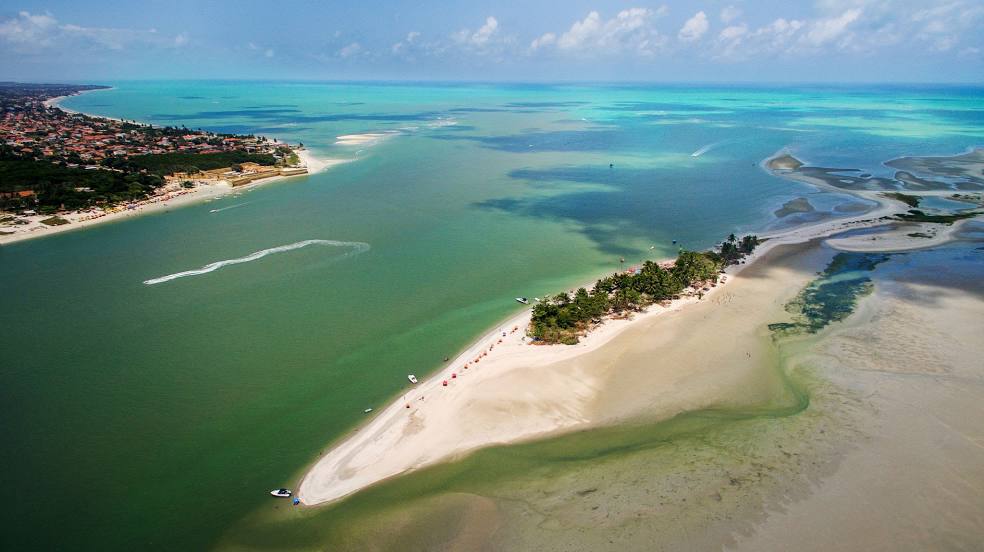
Guanambi — Itapissuma distance, route on the map
Distance by car
Distance between Guanambi, Bahia, Brazil and Itapissuma, Pernambuco, Brazil by car is — km, or miles. To travel this distance by car, you need minute, or h.
Route on the map, driving directions
Car route Guanambi — Itapissuma was created automatically. The road on the map is shown as a blue line. By moving the markers, you can create a new route through the points you need.
Passing cities through which the car route passes: Caetité, Brumado, Santo Estêvão, Feira de Santana, Teodoro Sampaio, Alagoinhas, Entre Rios, Esplanada, Estância, São Cristóvão, Laranjeiras, Maruim, Igreja Nova, Junqueiro, São Miguel dos Campos, Pilar, Urubá, Rio Largo, Messias, Flexeiras, Joaquim Gomes, Palmares, Joaquim Nabuco, Gameleira, Escada, Cabo de Santo Agostinho, Jaboatão dos Guararapes, Jaboatão dos Guararapes, Recife International Airport, Camaragibe, Abreu e Lima, Crown airfield airplane, Igarassu.
Distance by plane
If you decide to take a trip Guanambi Itapissuma by plane, then you have to fly the distance — 1120 km or 694 miles. It is marked on the map with a gray line (between two points in a straight line).
Flight time
Estimated flight time Guanambi Itapissuma by plane at cruising speed 750 km / h will be — 1 h. and 29 min.
Direction of movement
Brazil, Guanambi — right-hand traffic. Brazil, Itapissuma — right-hand traffic.
Difference in time
Guanambi and Itapissuma are in the same time zone. Between them there is no time difference (UTC -3 America/Fortaleza).
Interesting Facts
Information on alternative ways to get to your destination.
The length of this distance is about 2.8% of the total length of the equator.
The percentage of the population is clearly shown in the graph:
Guanambi — 58,879, Itapissuma — 16,674 residents (less by 42,205).
The cost of travel
Calculate the cost of the trip yourself using the fuel consumption calculator, changing the data in the table.