
 Mikhaylovka
Dyrestuy
Mikhaylovka
Mayskiy
Novobessergenevka
Tersky District
Lesnoy
Tertezh
Kuz'minskiye Otverzhki
Mikhaylovka
Dyrestuy
Mikhaylovka
Mayskiy
Novobessergenevka
Tersky District
Lesnoy
Tertezh
Kuz'minskiye Otverzhki
Park Kul'tury I Otdykha "Sovetskiy" on the map, Omsk, Russian Federation
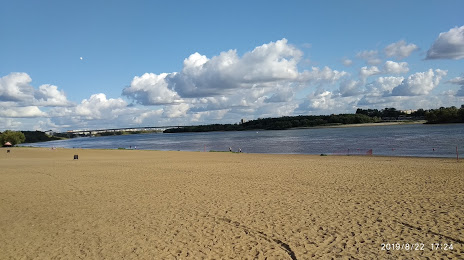
Photo
Where is located Park Kul'tury I Otdykha "Sovetskiy"
Park Kul'tury I Otdykha "Sovetskiy" — local attraction, which is located at Ulitsa Andrianova, 3, Omsk, Omsk Oblast, 644029 and belongs to the category — park. Average visitor rating for this place — 4.3 (according to 6462 ratings, information from open sources and relevant for 2022).
Exact location — Park Kul'tury I Otdykha "Sovetskiy", marked on the map with a red marker.
You can get directions to Park Kul'tury I Otdykha "Sovetskiy" on the map from your location.
What else is interesting in Omsk? You can see all the sights if you go to the city page.
Coordinates
Park Kul'tury I Otdykha "Sovetskiy", Russian Federation coordinates in decimal format: latitude — 55.02371140961624, longitude — 73.27651489842735. When converted to degrees, minutes, seconds Park Kul'tury I Otdykha "Sovetskiy" has the following coordinates: 55°1′25.36 north latitude and 73°16′35.45 east longitude.
Nearby cities
The largest cities that are located nearby:
- Kokshetau
 (Kazakhstan) — 322 km
 - Ekibastuz (Kazakhstan) — 384 km
- Pavlodar (Kazakhstan) — 385 km
- Kurgan — 505 km
- Tyumen — 528 km
- Temirtau (Kazakhstan) — 546 km
- Novosibirsk — 607 km
- Rubtsovsk — 661 km
- Kostanay (Kazakhstan) — 673 km
- Nefteyugansk — 677 km
- Nizhnevartovsk — 681 km
- Surgut — 693 km
- Semey (Kazakhstan) — 700 km
- Barnaul — 710 km
- Seversk — 721 km
- Tomsk — 729 km
- Chelyabinsk — 754 km
- Yekaterinburg — 799 km
- Leninsk-Kuznetskiy — 819 km
Distance to the capital
Distance to the capital (Moscow) is about — 2229 km.