
 Mikhaylovka
Dyrestuy
Mikhaylovka
Mayskiy
Novobessergenevka
Tersky District
Lesnoy
Tertezh
Kuz'minskiye Otverzhki
Mikhaylovka
Dyrestuy
Mikhaylovka
Mayskiy
Novobessergenevka
Tersky District
Lesnoy
Tertezh
Kuz'minskiye Otverzhki
Fort # 5 "Frederick William III" on the map, Kaliningrad, Russian Federation
Photo
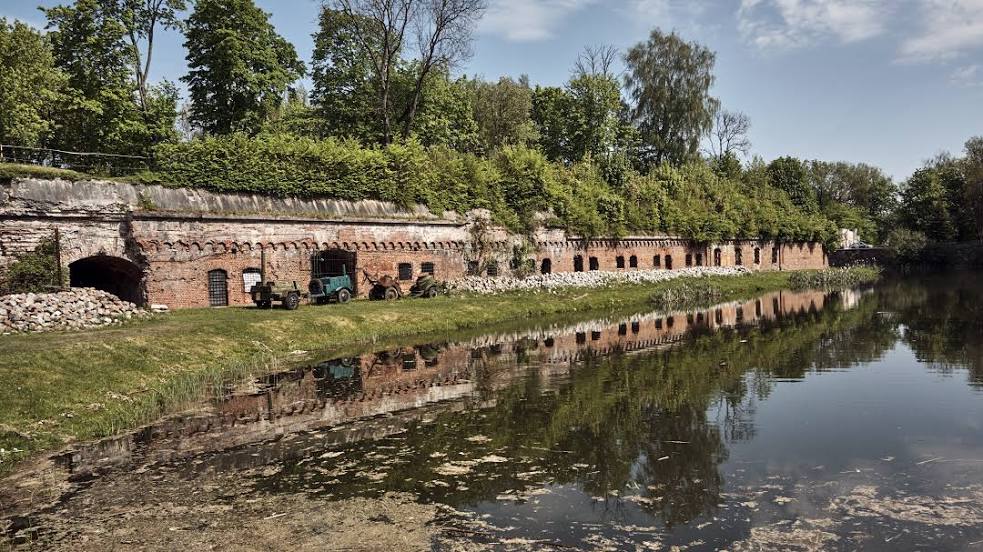
Where is located Fort # 5 "Frederick William III"
Fort # 5 "Frederick William III" — local attraction, which is located at Ulitsa Bulatova, Kaliningrad, Kaliningrad Oblast, 236019 and belongs to the category — historical landmark. Average visitor rating for this place — 4.7 (according to 3282 ratings, information from open sources and relevant for 2022).
Exact location — Fort # 5 "Frederick William III", marked on the map with a red marker.
You can get directions to Fort # 5 "Frederick William III" on the map from your location.
What else is interesting in Kaliningrad? You can see all the sights if you go to the city page.
Coordinates
Fort # 5 "Frederick William III", Russian Federation coordinates in decimal format: latitude — 54.75276898486451, longitude — 20.442882598416855. When converted to degrees, minutes, seconds Fort # 5 "Frederick William III" has the following coordinates: 54°45′9.97 north latitude and 20°26′34.38 east longitude.
Nearby cities
The largest cities that are located nearby:
- Elblag
 (Poland) — 95 km
 - Olsztyn (Poland) — 104 km
- Klaipėda
 (Lithuania) — 116 km
 - Gdańsk (Poland) — 127 km
- Gdynia (Poland) — 129 km
- Kaunas (Lithuania) — 216 km
- Šiauliai (Lithuania) — 219 km
- Torun (Poland) — 227 km
- Bydgoszcz (Poland) — 242 km
- Plock (Poland) — 246 km
- Bialystok (Poland) — 248 km
- Wloclawek (Poland) — 248 km
- Panevėžys (Lithuania) — 264 km
- Warsaw (Poland) — 277 km
- Koszalin (Poland) — 287 km
- Vilnius (Lithuania) — 304 km
- Rīga
 (Latvia) — 328 km
 - Łódź (Poland) — 335 km
- Poznań (Poland) — 352 km
Distance to the capital
Distance to the capital (Moscow) is about — 1092 km.