
 Mikhaylovka
Dyrestuy
Mikhaylovka
Mayskiy
Novobessergenevka
Tersky District
Lesnoy
Tertezh
Kuz'minskiye Otverzhki
Mikhaylovka
Dyrestuy
Mikhaylovka
Mayskiy
Novobessergenevka
Tersky District
Lesnoy
Tertezh
Kuz'minskiye Otverzhki
Gosudarstvennyy Muzey Istorii Sankt-Peterburga on the map, Saint Petersburg, Russian Federation
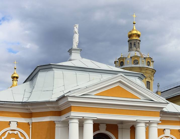
Photo
Where is located Gosudarstvennyy Muzey Istorii Sankt-Peterburga
Gosudarstvennyy Muzey Istorii Sankt-Peterburga — local attraction, which is located at Петропавловская крепость, д.3, St Petersburg, 197046 and belongs to the category — museum. Average visitor rating for this place — 4.6 (according to 125 ratings, information from open sources and relevant for 2022).
Exact location — Gosudarstvennyy Muzey Istorii Sankt-Peterburga, marked on the map with a red marker.
You can get directions to Gosudarstvennyy Muzey Istorii Sankt-Peterburga on the map from your location.
What else is interesting in Saint Petersburg? You can see all the sights if you go to the city page.
Coordinates
Gosudarstvennyy Muzey Istorii Sankt-Peterburga, Russian Federation coordinates in decimal format: latitude — 59.949836837060744, longitude — 30.31675399862233. When converted to degrees, minutes, seconds Gosudarstvennyy Muzey Istorii Sankt-Peterburga has the following coordinates: 59°56′59.41 north latitude and 30°19′0.31 east longitude.
Nearby cities
The largest cities that are located nearby:
- Kolpino — 27 km
- Pskov — 262 km
- Tartu
 (Estonia) — 271 km
 - Petrozavodsk — 292 km
- Vantaa
 (Finland) — 293 km
 - Helsinki (Finland) — 298 km
- Espoo (Finland) — 313 km
- Tallinn (Estonia) — 319 km
- Tampere (Finland) — 388 km
- Velikiye Luki — 398 km
- Cherepovets — 439 km
- Turku (Finland) — 444 km
- Tver — 479 km
- Rīga
 (Latvia) — 500 km
 - Navapolatsk
 (Belarus) — 501 km
 - Daugavpils (Latvia) — 507 km
- Rybinsk — 539 km
- Vologda — 547 km
- Smolensk — 579 km
Distance to the capital
Distance to the capital (Moscow) is about — 635 km.