
 Mikhaylovka
Dyrestuy
Mikhaylovka
Mayskiy
Novobessergenevka
Tersky District
Lesnoy
Tertezh
Kuz'minskiye Otverzhki
Mikhaylovka
Dyrestuy
Mikhaylovka
Mayskiy
Novobessergenevka
Tersky District
Lesnoy
Tertezh
Kuz'minskiye Otverzhki
Kol'tsovskiy Skver on the map, Voronezh, Russian Federation
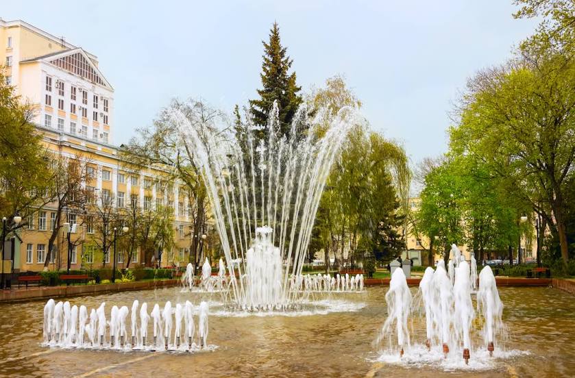
Photo
Where is located Kol'tsovskiy Skver
Kol'tsovskiy Skver — local attraction, which is located at Ulitsa Dzerzhinskogo, 12А, Voronezh, Voronezh Oblast, 394018 and belongs to the category — park. Average visitor rating for this place — 4.7 (according to 5909 ratings, information from open sources and relevant for 2022).
Exact location — Kol'tsovskiy Skver, marked on the map with a red marker.
You can get directions to Kol'tsovskiy Skver on the map from your location.
What else is interesting in Voronezh? You can see all the sights if you go to the city page.
Coordinates
Kol'tsovskiy Skver, Russian Federation coordinates in decimal format: latitude — 51.66210077420293, longitude — 39.20194439830065. When converted to degrees, minutes, seconds Kol'tsovskiy Skver has the following coordinates: 51°39′43.56 north latitude and 39°12′7 east longitude.
Nearby cities
The largest cities that are located nearby:
- Lipetsk — 107 km
- Yelets — 114 km
- Tambov — 188 km
- Kursk — 209 km
- Belgorod — 218 km
- Novomoskovsk — 265 km
- Tula — 298 km
- Sumy
 (Ukraine) — 319 km
 - Ryazan — 326 km
- Luhansk
 — 343 km
 - Alchevs'k — 355 km
- Bryansk — 362 km
- Kaluga — 369 km
- Serpukhov — 376 km
- Kolomna — 379 km
- Horlivka — 382 km
- Poltava (Ukraine) — 406 km
- Obninsk — 415 km
- Donetsk — 418 km
Distance to the capital
Distance to the capital (Moscow) is about — 467 km.