
 Mikhaylovka
Dyrestuy
Mikhaylovka
Mayskiy
Novobessergenevka
Tersky District
Lesnoy
Tertezh
Kuz'minskiye Otverzhki
Mikhaylovka
Dyrestuy
Mikhaylovka
Mayskiy
Novobessergenevka
Tersky District
Lesnoy
Tertezh
Kuz'minskiye Otverzhki
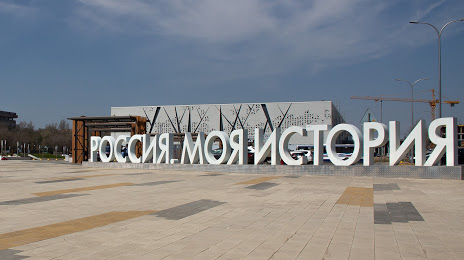
Russia - Moya Istoriya on the map, Volgograd, Russian Federation
Photo
Where is located Russia - Moya Istoriya
Russia - Moya Istoriya — local attraction, which is located at Ulitsa Haberezhnaya 62-Y Armii, 1 Б, Volgograd, Volgograd Oblast, 400066 and belongs to the category — history museum. Average visitor rating for this place — 4.6 (according to 1648 ratings, information from open sources and relevant for 2022).
Exact location — Russia - Moya Istoriya, marked on the map with a red marker.
You can get directions to Russia - Moya Istoriya on the map from your location.
What else is interesting in Volgograd? You can see all the sights if you go to the city page.
Coordinates
Russia - Moya Istoriya, Russian Federation coordinates in decimal format: latitude — 48.700303783207644, longitude — 44.51237729819367. When converted to degrees, minutes, seconds Russia - Moya Istoriya has the following coordinates: 48°42′1.09 north latitude and 44°30′44.56 east longitude.
Nearby cities
The largest cities that are located nearby:
- Volzhskiy — 20 km
- Kamyshin — 165 km
- Volgodonsk — 219 km
- Elista — 264 km
- Engels — 329 km
- Saratov — 330 km
- Shakhty — 337 km
- Novocherkassk — 361 km
- Astrakhan — 374 km
- Luhansk
 — 381 km
 - Bataysk — 399 km
- Alchevs'k — 420 km
- Balakovo — 430 km
- Stavropol — 449 km
- Taganrog — 451 km
- Horlivka — 479 km
- Tambov — 490 km
- Voronezh — 491 km
- Nevinnomyssk — 493 km
Distance to the capital
Distance to the capital (Moscow) is about — 914 km.