
 Mikhaylovka
Dyrestuy
Mikhaylovka
Mayskiy
Novobessergenevka
Tersky District
Lesnoy
Tertezh
Kuz'minskiye Otverzhki
Mikhaylovka
Dyrestuy
Mikhaylovka
Mayskiy
Novobessergenevka
Tersky District
Lesnoy
Tertezh
Kuz'minskiye Otverzhki
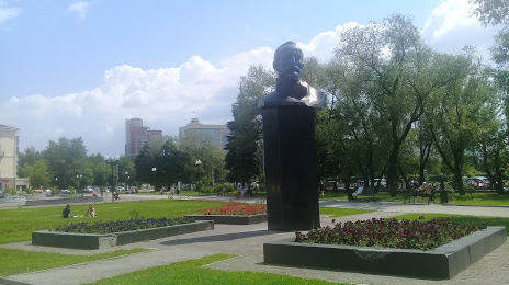
Skver im. F. E. Dzerzhinskogo on the map, Perm, Russian Federation
Photo
Where is located Skver im. F. E. Dzerzhinskogo
Skver im. F. E. Dzerzhinskogo — local attraction, which is located at Ulitsa Khokhryakova, Perm, Perm Krai, 614068 and belongs to the category — park. Average visitor rating for this place — 4.6 (according to 2178 ratings, information from open sources and relevant for 2022).
Exact location — Skver im. F. E. Dzerzhinskogo, marked on the map with a red marker.
You can get directions to Skver im. F. E. Dzerzhinskogo on the map from your location.
What else is interesting in Perm? You can see all the sights if you go to the city page.
Coordinates
Skver im. F. E. Dzerzhinskogo, Russian Federation coordinates in decimal format: latitude — 58.003686575000955, longitude — 56.19860599854404. When converted to degrees, minutes, seconds Skver im. F. E. Dzerzhinskogo has the following coordinates: 58°0′13.27 north latitude and 56°11′54.98 east longitude.
Nearby cities
The largest cities that are located nearby:
- Berezniki — 159 km
- Solikamsk — 183 km
- Glazov — 214 km
- Sarapul — 229 km
- Izhevsk — 229 km
- Neftekamsk — 244 km
- Pervouralsk — 250 km
- Yekaterinburg — 289 km
- Ufa — 361 km
- Zlatoust — 378 km
- Nizhnekamsk — 384 km
- Kirov — 389 km
- Miass — 409 km
- Almetyevsk — 427 km
- Chelyabinsk — 450 km
- Sterlitamak — 483 km
- Syktyvkar — 498 km
- Kazan — 509 km
- Salavat — 513 km
Distance to the capital
Distance to the capital (Moscow) is about — 1153 km.