
 Mikhaylovka
Dyrestuy
Mikhaylovka
Mayskiy
Novobessergenevka
Tersky District
Lesnoy
Tertezh
Kuz'minskiye Otverzhki
Mikhaylovka
Dyrestuy
Mikhaylovka
Mayskiy
Novobessergenevka
Tersky District
Lesnoy
Tertezh
Kuz'minskiye Otverzhki
Vologodskiy Istoriko-Arkhitekturnyy I Khudozhestvennyy Muzey on the map, Vologda, Russian Federation
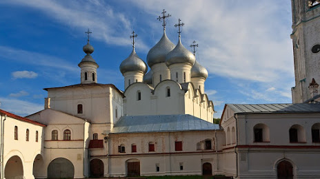
Photo
Where is located Vologodskiy Istoriko-Arkhitekturnyy I Khudozhestvennyy Muzey
Vologodskiy Istoriko-Arkhitekturnyy I Khudozhestvennyy Muzey — local attraction, which is located at Ulitsa Sergeya Orlova, 15, Vologda, Vologda Oblast, 160035 and belongs to the category — museum. Average visitor rating for this place — 4.8 (according to 170 ratings, information from open sources and relevant for 2022).
Exact location — Vologodskiy Istoriko-Arkhitekturnyy I Khudozhestvennyy Muzey, marked on the map with a red marker.
You can get directions to Vologodskiy Istoriko-Arkhitekturnyy I Khudozhestvennyy Muzey on the map from your location.
What else is interesting in Vologda? You can see all the sights if you go to the city page.
Coordinates
Vologodskiy Istoriko-Arkhitekturnyy I Khudozhestvennyy Muzey, Russian Federation coordinates in decimal format: latitude — 59.22399489131874, longitude — 39.882509998592894. When converted to degrees, minutes, seconds Vologodskiy Istoriko-Arkhitekturnyy I Khudozhestvennyy Muzey has the following coordinates: 59°13′26.38 north latitude and 39°52′57.04 east longitude.
Nearby cities
The largest cities that are located nearby:
- Cherepovets — 113 km
- Rybinsk — 143 km
- Kostroma — 172 km
- Yaroslavl — 176 km
- Kovrov — 327 km
- Vladimir — 341 km
- Tver — 355 km
- Pushkino — 378 km
- Noginsk — 380 km
- Orekhovo-Zuyevo — 382 km
- Elektrostal — 390 km
- Zelenograd — 393 km
- Balashikha — 395 km
- Dzerzhinsk — 396 km
- Khimki — 398 km
- Petrozavodsk — 406 km
- Lyubertsy — 410 km
- Murom — 425 km
- Odintsovo — 426 km
Distance to the capital
Distance to the capital (Moscow) is about — 409 km.