
 Mikhaylovka
Dyrestuy
Mikhaylovka
Mayskiy
Novobessergenevka
Tersky District
Lesnoy
Tertezh
Kuz'minskiye Otverzhki
Mikhaylovka
Dyrestuy
Mikhaylovka
Mayskiy
Novobessergenevka
Tersky District
Lesnoy
Tertezh
Kuz'minskiye Otverzhki
Stolby on the map, Krasnoyarsk, Russian Federation
Photo
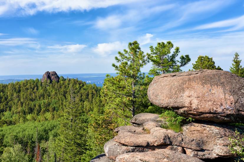
Where is located Stolby
Stolby — local attraction, which is located at Krasnoyarsk, Krasnoyarsk Krai, 660054 and belongs to the category — nature reserve. Average visitor rating for this place — 4.9 (according to 2090 ratings, information from open sources and relevant for 2022).
Exact location — Stolby, marked on the map with a red marker.
You can get directions to Stolby on the map from your location.
What else is interesting in Krasnoyarsk? You can see all the sights if you go to the city page.
Coordinates
Stolby, Russian Federation coordinates in decimal format: latitude — 55.93551070402536, longitude — 92.74156949846255. When converted to degrees, minutes, seconds Stolby has the following coordinates: 55°56′7.84 north latitude and 92°44′29.65 east longitude.
Nearby cities
The largest cities that are located nearby:
- Achinsk — 149 km
- Kansk — 175 km
- Abakan — 272 km
- Mezhdurechensk — 409 km
- Novokuznetsk — 452 km
- Leninsk-Kuznetskiy — 456 km
- Prokopyevsk — 466 km
- Tomsk — 485 km
- Kyzyl — 487 km
- Seversk — 494 km
- Bratsk — 537 km
- Ust-Ilimsk — 613 km
- Novosibirsk — 641 km
- Biysk — 644 km
- Barnaul — 670 km
- Angarsk — 833 km
- Rubtsovsk — 946 km
- Altay
 (China) — 970 km
 - Oskemen
 (Kazakhstan) — 991 km
Distance to the capital
Distance to the capital (Moscow) is about — 3349 km.