
 Mikhaylovka
Dyrestuy
Mikhaylovka
Mayskiy
Novobessergenevka
Tersky District
Lesnoy
Tertezh
Kuz'minskiye Otverzhki
Mikhaylovka
Dyrestuy
Mikhaylovka
Mayskiy
Novobessergenevka
Tersky District
Lesnoy
Tertezh
Kuz'minskiye Otverzhki
Ozero Dolgoye on the map, Ozersk, Russian Federation
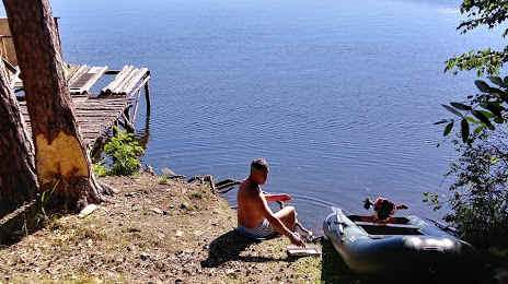
Photo
Where is located Ozero Dolgoye
Ozero Dolgoye — local attraction, which is located at no data and belongs to the category — -. Average visitor rating for this place — 4.7 (according to 19 ratings, information from open sources and relevant for 2022).
Exact location — Ozero Dolgoye, marked on the map with a red marker.
You can get directions to Ozero Dolgoye on the map from your location.
What else is interesting in Ozersk? You can see all the sights if you go to the city page.
Coordinates
Ozero Dolgoye, Russian Federation coordinates in decimal format: latitude — 55.83603595790909, longitude — 60.62806090335359. When converted to degrees, minutes, seconds Ozero Dolgoye has the following coordinates: 55°50′9.73 north latitude and 60°37′41.02 east longitude.
Nearby cities
The largest cities that are located nearby:
- Chelyabinsk — 79 km
- Miass — 92 km
- Zlatoust — 93 km
- Yekaterinburg — 121 km
- Pervouralsk — 137 km
- Magnitogorsk — 282 km
- Kurgan — 292 km
- Ufa — 323 km
- Tyumen — 328 km
- Kostanay
 (Kazakhstan) — 340 km
 - Perm — 358 km
- Sterlitamak — 390 km
- Neftekamsk — 398 km
- Salavat — 411 km
- Sarapul — 430 km
- Berezniki — 462 km
- Izhevsk — 471 km
- Solikamsk — 484 km
- Orsk — 525 km
Distance to the capital
Distance to the capital (Moscow) is about — 1432 km.