
 Mikhaylovka
Dyrestuy
Mikhaylovka
Mayskiy
Novobessergenevka
Tersky District
Lesnoy
Tertezh
Kuz'minskiye Otverzhki
Mikhaylovka
Dyrestuy
Mikhaylovka
Mayskiy
Novobessergenevka
Tersky District
Lesnoy
Tertezh
Kuz'minskiye Otverzhki
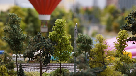
Shou-Maket Zolotoye Kol'tso on the map, Yaroslavl, Russian Federation
Photo
Where is located Shou-Maket Zolotoye Kol'tso
Shou-Maket Zolotoye Kol'tso — local attraction, which is located at Sovetskiy Pereulok, 2/23а, Yaroslavl, Yaroslavl Oblast, 150000 and belongs to the category — museum. Average visitor rating for this place — 4.8 (according to 976 ratings, information from open sources and relevant for 2022).
Exact location — Shou-Maket Zolotoye Kol'tso, marked on the map with a red marker.
You can get directions to Shou-Maket Zolotoye Kol'tso on the map from your location.
What else is interesting in Yaroslavl? You can see all the sights if you go to the city page.
Coordinates
Shou-Maket Zolotoye Kol'tso, Russian Federation coordinates in decimal format: latitude — 57.62720097701485, longitude — 39.89735299852906. When converted to degrees, minutes, seconds Shou-Maket Zolotoye Kol'tso has the following coordinates: 57°37′37.92 north latitude and 39°53′50.47 east longitude.
Nearby cities
The largest cities that are located nearby:
- Kostroma — 64 km
- Rybinsk — 77 km
- Kovrov — 165 km
- Vladimir — 167 km
- Vologda — 176 km
- Cherepovets — 201 km
- Orekhovo-Zuyevo — 210 km
- Noginsk — 213 km
- Pushkino — 220 km
- Elektrostal — 222 km
- Balashikha — 233 km
- Khimki — 244 km
- Zelenograd — 245 km
- Lyubertsy — 248 km
- Tver — 254 km
- Murom — 264 km
- Izmaylovo — 268 km
- Dzerzhinsk — 268 km
- Odintsovo — 271 km
Distance to the capital
Distance to the capital (Moscow) is about — 250 km.