
 Mikhaylovka
Dyrestuy
Mikhaylovka
Mayskiy
Novobessergenevka
Tersky District
Lesnoy
Tertezh
Kuz'minskiye Otverzhki
Mikhaylovka
Dyrestuy
Mikhaylovka
Mayskiy
Novobessergenevka
Tersky District
Lesnoy
Tertezh
Kuz'minskiye Otverzhki
Botanicheskiy Sad Yagpu Im. K.d.ushinskogo on the map, Yaroslavl, Russian Federation
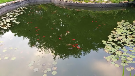
Photo
Where is located Botanicheskiy Sad Yagpu Im. K.d.ushinskogo
Botanicheskiy Sad Yagpu Im. K.d.ushinskogo — local attraction, which is located at Kotorosl'naya Naberezhnaya, 46Г, Yaroslavl, Yaroslavl Oblast, 150000 and belongs to the category — botanical garden. Average visitor rating for this place — 4.5 (according to 134 ratings, information from open sources and relevant for 2022).
Exact location — Botanicheskiy Sad Yagpu Im. K.d.ushinskogo, marked on the map with a red marker.
You can get directions to Botanicheskiy Sad Yagpu Im. K.d.ushinskogo on the map from your location.
What else is interesting in Yaroslavl? You can see all the sights if you go to the city page.
Coordinates
Botanicheskiy Sad Yagpu Im. K.d.ushinskogo, Russian Federation coordinates in decimal format: latitude — 57.62065020135825, longitude — 39.874344198528746. When converted to degrees, minutes, seconds Botanicheskiy Sad Yagpu Im. K.d.ushinskogo has the following coordinates: 57°37′14.34 north latitude and 39°52′27.64 east longitude.
Nearby cities
The largest cities that are located nearby:
- Kostroma — 64 km
- Rybinsk — 77 km
- Kovrov — 165 km
- Vladimir — 167 km
- Vologda — 176 km
- Cherepovets — 201 km
- Orekhovo-Zuyevo — 210 km
- Noginsk — 213 km
- Pushkino — 220 km
- Elektrostal — 222 km
- Balashikha — 233 km
- Khimki — 244 km
- Zelenograd — 245 km
- Lyubertsy — 248 km
- Tver — 254 km
- Murom — 264 km
- Izmaylovo — 268 km
- Dzerzhinsk — 268 km
- Odintsovo — 271 km
Distance to the capital
Distance to the capital (Moscow) is about — 249 km.