
 Mikhaylovka
Dyrestuy
Mikhaylovka
Mayskiy
Novobessergenevka
Tersky District
Lesnoy
Tertezh
Kuz'minskiye Otverzhki
Mikhaylovka
Dyrestuy
Mikhaylovka
Mayskiy
Novobessergenevka
Tersky District
Lesnoy
Tertezh
Kuz'minskiye Otverzhki
Svyato-Uspenskiy Kafedral'nyy Sobor on the map, Vladimir, Russian Federation
Photo
Where is located Svyato-Uspenskiy Kafedral'nyy Sobor
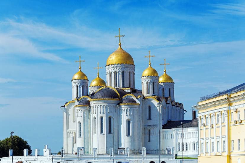
Svyato-Uspenskiy Kafedral'nyy Sobor — local attraction, which is located at Bolshaya Moskovskaya St, 56, Vladimir, Vladimir Oblast, 600000 and belongs to the category — cathedral. Average visitor rating for this place — 4.8 (according to 1931 rating, information from open sources and relevant for 2022).
Exact location — Svyato-Uspenskiy Kafedral'nyy Sobor, marked on the map with a red marker.
You can get directions to Svyato-Uspenskiy Kafedral'nyy Sobor on the map from your location.
What else is interesting in Vladimir? You can see all the sights if you go to the city page.
Coordinates
Svyato-Uspenskiy Kafedral'nyy Sobor, Russian Federation coordinates in decimal format: latitude — 56.12744930359844, longitude — 40.40903819847011. When converted to degrees, minutes, seconds Svyato-Uspenskiy Kafedral'nyy Sobor has the following coordinates: 56°7′38.82 north latitude and 40°24′32.54 east longitude.
Nearby cities
The largest cities that are located nearby:
- Kovrov — 61 km
- Orekhovo-Zuyevo — 98 km
- Murom — 120 km
- Noginsk — 125 km
- Elektrostal — 128 km
- Kolomna — 156 km
- Balashikha — 157 km
- Pushkino — 161 km
- Lyubertsy — 165 km
- Yaroslavl — 167 km
- Ryazan — 176 km
- Kostroma — 182 km
- Izmaylovo — 185 km
- Khimki — 186 km
- Dzerzhinsk — 187 km
- Podolsk — 197 km
- Zelenograd — 200 km
- Odintsovo — 204 km
- Arzamas — 229 km
Distance to the capital
Distance to the capital (Moscow) is about — 179 km.