
 Mikhaylovka
Dyrestuy
Mikhaylovka
Mayskiy
Novobessergenevka
Tersky District
Lesnoy
Tertezh
Kuz'minskiye Otverzhki
Mikhaylovka
Dyrestuy
Mikhaylovka
Mayskiy
Novobessergenevka
Tersky District
Lesnoy
Tertezh
Kuz'minskiye Otverzhki
Metelitsa on the map, Tomsk, Russian Federation
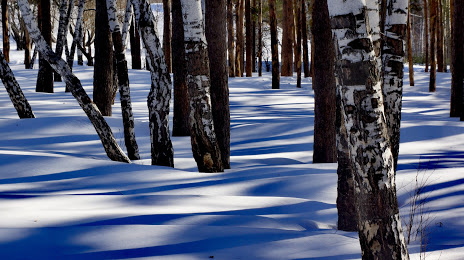
Photo
Where is located Metelitsa
Metelitsa — local attraction, which is located at Ulitsa Koroleva, 13, Tomsk, Tomsk Oblast, 634055 and belongs to the category — ski resort. Average visitor rating for this place — 4.7 (according to 791 rating, information from open sources and relevant for 2022).
Exact location — Metelitsa, marked on the map with a red marker.
You can get directions to Metelitsa on the map from your location.
What else is interesting in Tomsk? You can see all the sights if you go to the city page.
Coordinates
Metelitsa, Russian Federation coordinates in decimal format: latitude — 56.491672856993105, longitude — 84.99247139699365. When converted to degrees, minutes, seconds Metelitsa has the following coordinates: 56°29′30.02 north latitude and 84°59′32.9 east longitude.
Nearby cities
The largest cities that are located nearby:
- Seversk — 14 km
- Novosibirsk — 210 km
- Leninsk-Kuznetskiy — 217 km
- Prokopyevsk — 310 km
- Novokuznetsk — 334 km
- Achinsk — 339 km
- Barnaul — 357 km
- Mezhdurechensk — 370 km
- Biysk — 439 km
- Krasnoyarsk — 491 km
- Abakan — 521 km
- Rubtsovsk — 610 km
- Kansk — 660 km
- Nizhnevartovsk — 669 km
- Pavlodar
 (Kazakhstan) — 715 km
 - Oskemen (Kazakhstan) — 741 km
- Semey (Kazakhstan) — 750 km
- Omsk — 756 km
- Surgut — 808 km
Distance to the capital
Distance to the capital (Moscow) is about — 2880 km.