
 Mikhaylovka
Dyrestuy
Mikhaylovka
Mayskiy
Novobessergenevka
Tersky District
Lesnoy
Tertezh
Kuz'minskiye Otverzhki
Mikhaylovka
Dyrestuy
Mikhaylovka
Mayskiy
Novobessergenevka
Tersky District
Lesnoy
Tertezh
Kuz'minskiye Otverzhki
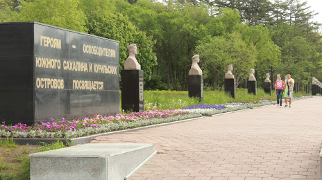
Ploshchad' Slavy on the map, Yuzhno-Sakhalinsk, Russian Federation
Photo
Where is located Ploshchad' Slavy
Ploshchad' Slavy — local attraction, which is located at Yuzhno-Sakhalinsk, Sakhalin Oblast, 693010 and belongs to the category — tourist attraction. Average visitor rating for this place — 4.7 (according to 1976 ratings, information from open sources and relevant for 2022).
Exact location — Ploshchad' Slavy, marked on the map with a red marker.
You can get directions to Ploshchad' Slavy on the map from your location.
What else is interesting in Yuzhno-Sakhalinsk? You can see all the sights if you go to the city page.
Coordinates
Ploshchad' Slavy, Russian Federation coordinates in decimal format: latitude — 46.96088735589834, longitude — 142.75653409813305. When converted to degrees, minutes, seconds Ploshchad' Slavy has the following coordinates: 46°57′39.19 north latitude and 142°45′23.52 east longitude.
Nearby cities
The largest cities that are located nearby:
- Asahikawa
 (Japan) — 355 km
 - Kitami (Japan) — 362 km
- Ebetsu (Japan) — 438 km
- Otaru (Japan) — 440 km
- Sapporo (Japan) — 446 km
- Obihiro (Japan) — 449 km
- Tomakomai (Japan) — 488 km
- Komsomolsk-on-Amur — 566 km
- Khabarovsk — 587 km
- Hakodate (Japan) — 598 km
- Aomori (Japan) — 699 km
- Hachinohe (Japan) — 721 km
- Hirosaki (Japan) — 729 km
- Morioka (Japan) — 814 km
- Akita (Japan) — 832 km
- Nakhodka — 922 km
- Sakata (Japan) — 924 km
- Ussuriysk — 928 km
- Hegang
 (China) — 932 km
Distance to the capital
Distance to the capital (Moscow) is about — 6645 km.