
 Mikhaylovka
Dyrestuy
Mikhaylovka
Mayskiy
Novobessergenevka
Tersky District
Lesnoy
Tertezh
Kuz'minskiye Otverzhki
Mikhaylovka
Dyrestuy
Mikhaylovka
Mayskiy
Novobessergenevka
Tersky District
Lesnoy
Tertezh
Kuz'minskiye Otverzhki
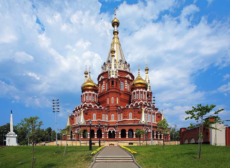
Mikhailo-Arkhangel'skiy Kafedral'nyy Sobor on the map, Izhevsk, Russian Federation
Photo
Where is located Mikhailo-Arkhangel'skiy Kafedral'nyy Sobor
Mikhailo-Arkhangel'skiy Kafedral'nyy Sobor — local attraction, which is located at Ulitsa K. Marksa, 222, Izhevsk, Udmurt Republic, 426008 and belongs to the category — russian orthodox church. Average visitor rating for this place — 4.8 (according to 916 ratings, information from open sources and relevant for 2022).
Exact location — Mikhailo-Arkhangel'skiy Kafedral'nyy Sobor, marked on the map with a red marker.
You can get directions to Mikhailo-Arkhangel'skiy Kafedral'nyy Sobor on the map from your location.
What else is interesting in Izhevsk? You can see all the sights if you go to the city page.
Coordinates
Mikhailo-Arkhangel'skiy Kafedral'nyy Sobor, Russian Federation coordinates in decimal format: latitude — 56.849738953741415, longitude — 53.20535919849833. When converted to degrees, minutes, seconds Mikhailo-Arkhangel'skiy Kafedral'nyy Sobor has the following coordinates: 56°50′59.06 north latitude and 53°12′19.29 east longitude.
Nearby cities
The largest cities that are located nearby:
- Sarapul — 55 km
- Neftekamsk — 106 km
- Glazov — 147 km
- Nizhnekamsk — 158 km
- Almetyevsk — 221 km
- Perm — 224 km
- Kazan — 277 km
- Kirov — 282 km
- Ufa — 292 km
- Zelenodolsk — 309 km
- Yoshkar-Ola — 324 km
- Berezniki — 350 km
- Novocheboksarsk — 359 km
- Solikamsk — 369 km
- Dimitrovgrad — 371 km
- Cheboksary — 374 km
- Sterlitamak — 398 km
- Pervouralsk — 409 km
- Ulyanovsk — 417 km
Distance to the capital
Distance to the capital (Moscow) is about — 967 km.