
 Mikhaylovka
Dyrestuy
Mikhaylovka
Mayskiy
Novobessergenevka
Tersky District
Lesnoy
Tertezh
Kuz'minskiye Otverzhki
Mikhaylovka
Dyrestuy
Mikhaylovka
Mayskiy
Novobessergenevka
Tersky District
Lesnoy
Tertezh
Kuz'minskiye Otverzhki
Gora Magnitnaya on the map, Magnitogorsk, Russian Federation
Photo
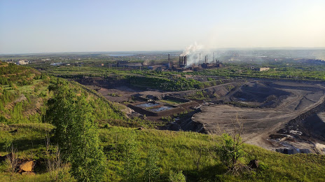
Where is located Gora Magnitnaya
Gora Magnitnaya — local attraction, which is located at 616 m and belongs to the category — -. Average visitor rating for this place — 4.2 (according to 10 ratings, information from open sources and relevant for 2022).
Exact location — Gora Magnitnaya, marked on the map with a red marker.
You can get directions to Gora Magnitnaya on the map from your location.
What else is interesting in Magnitogorsk? You can see all the sights if you go to the city page.
Coordinates
Gora Magnitnaya, Russian Federation coordinates in decimal format: latitude — 53.429533250083374, longitude — 59.11361109742474. When converted to degrees, minutes, seconds Gora Magnitnaya has the following coordinates: 53°25′46.32 north latitude and 59°6′49 east longitude.
Nearby cities
The largest cities that are located nearby:
- Miass — 189 km
- Zlatoust — 198 km
- Sterlitamak — 202 km
- Salavat — 202 km
- Ufa — 243 km
- Orsk — 247 km
- Chelyabinsk — 247 km
- Novotroitsk — 249 km
- Kostanay
 (Kazakhstan) — 308 km
 - Orenburg — 323 km
- Yekaterinburg — 391 km
- Pervouralsk — 392 km
- Neftekamsk — 416 km
- Almetyevsk — 455 km
- Kurgan — 458 km
- Sarapul — 464 km
- Nizhnekamsk — 511 km
- Izhevsk — 517 km
- Perm — 531 km
Distance to the capital
Distance to the capital (Moscow) is about — 1403 km.