
 Mikhaylovka
Dyrestuy
Mikhaylovka
Mayskiy
Novobessergenevka
Tersky District
Lesnoy
Tertezh
Kuz'minskiye Otverzhki
Mikhaylovka
Dyrestuy
Mikhaylovka
Mayskiy
Novobessergenevka
Tersky District
Lesnoy
Tertezh
Kuz'minskiye Otverzhki
Svyato-Troitskiy Kafedral'nyy Sobor on the map, Pskov, Russian Federation
Photo
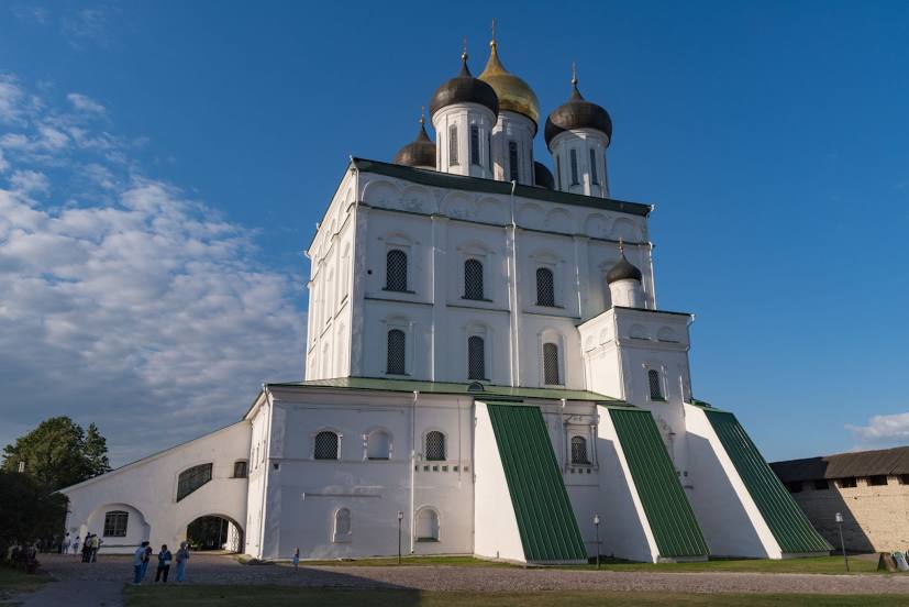
Where is located Svyato-Troitskiy Kafedral'nyy Sobor
Svyato-Troitskiy Kafedral'nyy Sobor — local attraction, which is located at Ulitsa Kreml', Pskov, Pskov Oblast, 180000 and belongs to the category — church. Average visitor rating for this place — 4.9 (according to 343 ratings, information from open sources and relevant for 2022).
Exact location — Svyato-Troitskiy Kafedral'nyy Sobor, marked on the map with a red marker.
You can get directions to Svyato-Troitskiy Kafedral'nyy Sobor on the map from your location.
What else is interesting in Pskov? You can see all the sights if you go to the city page.
Coordinates
Svyato-Troitskiy Kafedral'nyy Sobor, Russian Federation coordinates in decimal format: latitude — 57.82219385159439, longitude — 28.328975298536804. When converted to degrees, minutes, seconds Svyato-Troitskiy Kafedral'nyy Sobor has the following coordinates: 57°49′19.9 north latitude and 28°19′44.31 east longitude.
Nearby cities
The largest cities that are located nearby:
- Tartu
 (Estonia) — 112 km
 - Velikiye Luki — 212 km
- Daugavpils
 (Latvia) — 242 km
 - Kolpino — 247 km
- Navapolatsk
 (Belarus) — 255 km
 - Saint Petersburg — 259 km
- Tallinn (Estonia) — 269 km
- Rīga (Latvia) — 272 km
- Helsinki
 (Finland) — 320 km
 - Vantaa (Finland) — 328 km
- Espoo (Finland) — 333 km
- Panevėžys
 (Lithuania) — 338 km
 - Šiauliai (Lithuania) — 374 km
- Vilnius (Lithuania) — 397 km
- Maladzyechna (Belarus) — 399 km
- Smolensk — 410 km
- Kaunas (Lithuania) — 428 km
- Minsk (Belarus) — 435 km
- Turku (Finland) — 441 km
Distance to the capital
Distance to the capital (Moscow) is about — 610 km.